Chris Roams
Travel, Adventures, and Photography
High Sierra Trail
August 22, 2017
The High Sierra Trail runs approximately 60 miles (depending on who's counting) across the Sierra Nevada Mountains, connecting the big tree groves in the western portion of Sequoia National Park to Mt Whitney, the highest peak in the lower 48 states on the extreme eastern edge of the park. Getting back down from the summit of Mt Whitney to a road requires another 12 miles of hiking on top of that.
The trail itself was built in the 1930's after the original boundaries of Sequoia National Park were expanded to include Mt Whitney. There are no roads in this portion of the Sierras so, faced with a nearly 300 mile drive around the southern end of the park to get to the new attraction, the park service got to the task of building a trail straight across the range. This video explains a bit more of how the trail came to be.
Although this trail may be shorter than the other, more famous, long distance hiking trail that ends at Mt Whitney, the John Muir Trail, it holds the distinction of having a complete lack of resupply and bailout options. You have to bring everything you need for the whole journey and if something goes wrong your choices are to either head back however far you came, continue on in the direction you're going, or summon a very expensive emergency helicopter ride (more on that later).
Before you can get started hiking however, you need to arrange transport. In our case this meant me dropping a car at Whitney Portal near the eastern end of the trail. Rob and Steph, who have been living the RV life since the spring, were picking me up and driving us all to the trailhead, where we would start our hike, over in Sequoia National Park.
Instead of making Rob and Steph drive their motorhome up the steep and narrow road to Whitney Portal, made famous in The Long Long Trailer, I strapped on my pack and headed down Whitney Portal National Recreation Trail. This trail was originally part of the Mt Whitney Trail (to the summit) before the construction of Whitney Portal Road allowed summertime hikers access higher up. It still sees use for summit attempts when the road is closed for the winter. This isn't to say the trail isn't worth hiking on its own merits: the rapid transition from the forest environment of Whitney Portal to the desert ecosystem at the Lone Pine Campground at the other end of the trail is a sight to see.
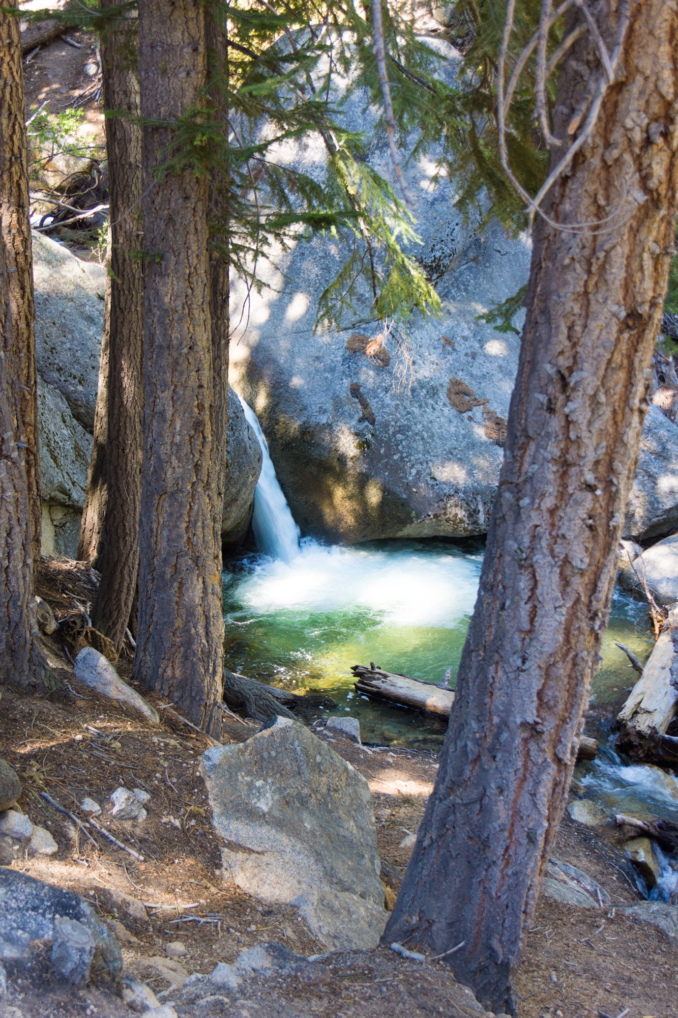 A small waterfall near the upper end of Whitney Portal Trail
 Looking back up along Whitney Portal Trail at Mt Whitney itself from the desert brush.
After 2 days of car shuttling we were finally ready to start on our hike from Crescent Meadow in Sequoia National Park. The first day would be about 12 mostly level miles with a final climb up to the tent hotel at Bearpaw Meadow where some very habituated deer wander around the backpacker campsites.
 Crescent Meadow trailhead
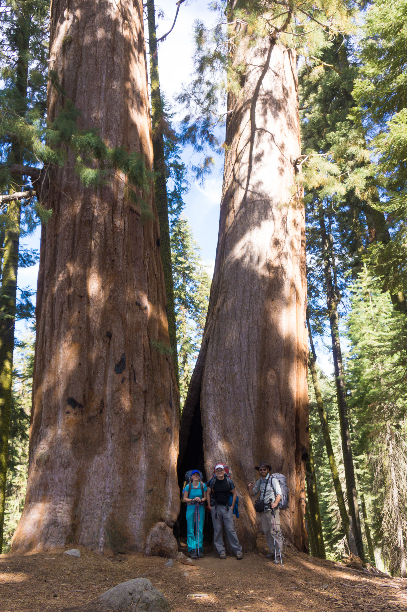 Sequoia tree near the trailhead.
 Eagle View, our first glimpse of what we were about to do.

Looking back past Moro Rock and down at California's central valley.

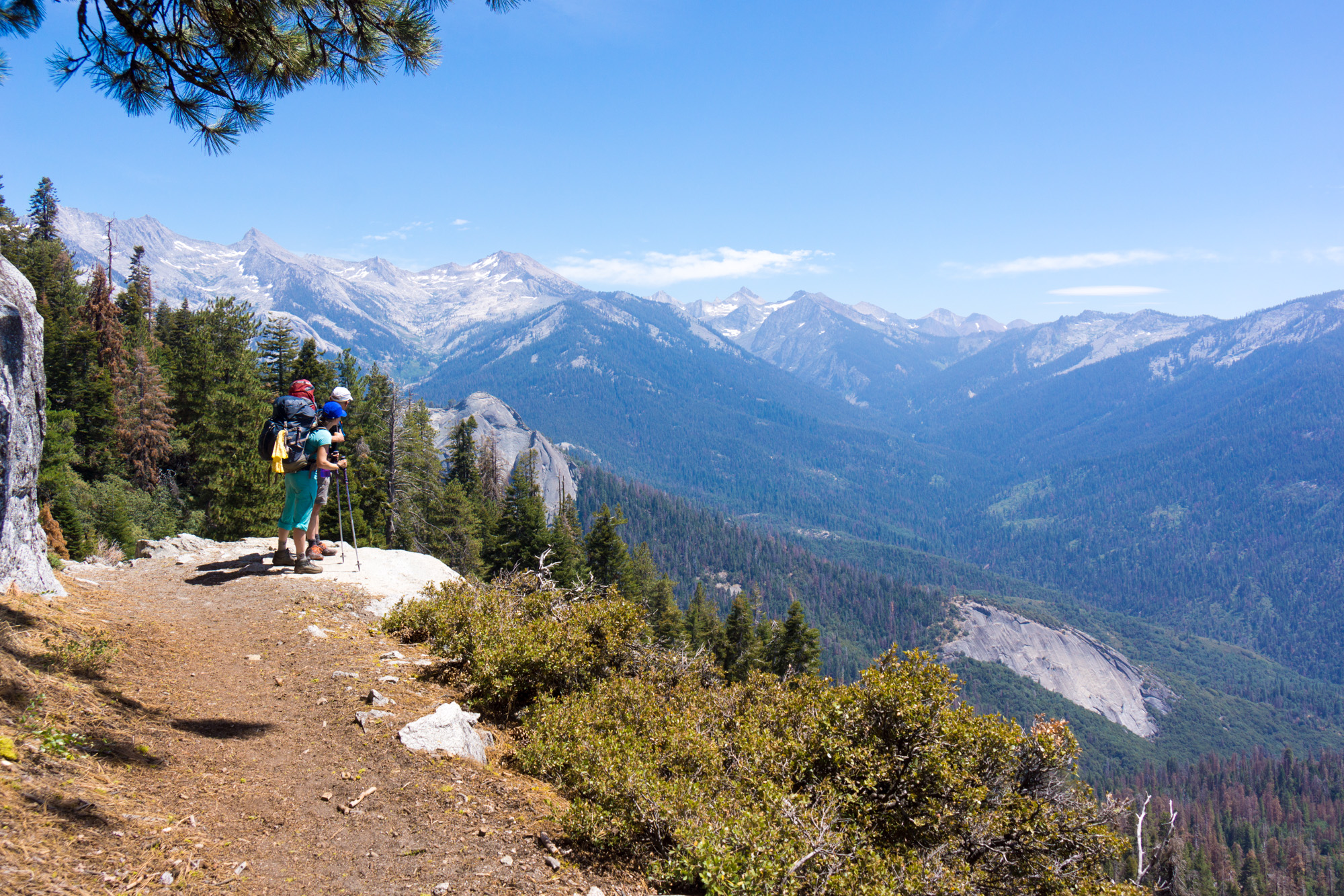


Our second day would take us another 12 miles from Bearpaw Meadow over the Kaweah Gap and into Big Arroyo. This required climbing all the way up from 8,500' to 10,700' before dropping back down to 9,500' on the other side. We spent most of the day looking up at the enormous wall of granite in front of us that we would take us until evening to cross.
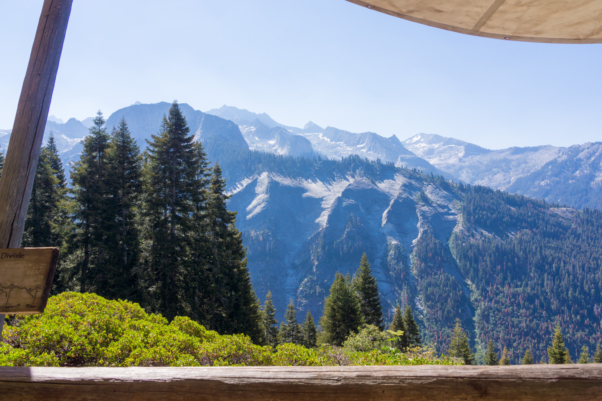 The view from the porch at Bearpaw Meadow.
 Our first look at the route ahead of us over Kaweah Gap.


 Hamilton Lake, quite possibly the most beautiful camping spot I've ever seen. Unfortunately we still had many miles to go that day.
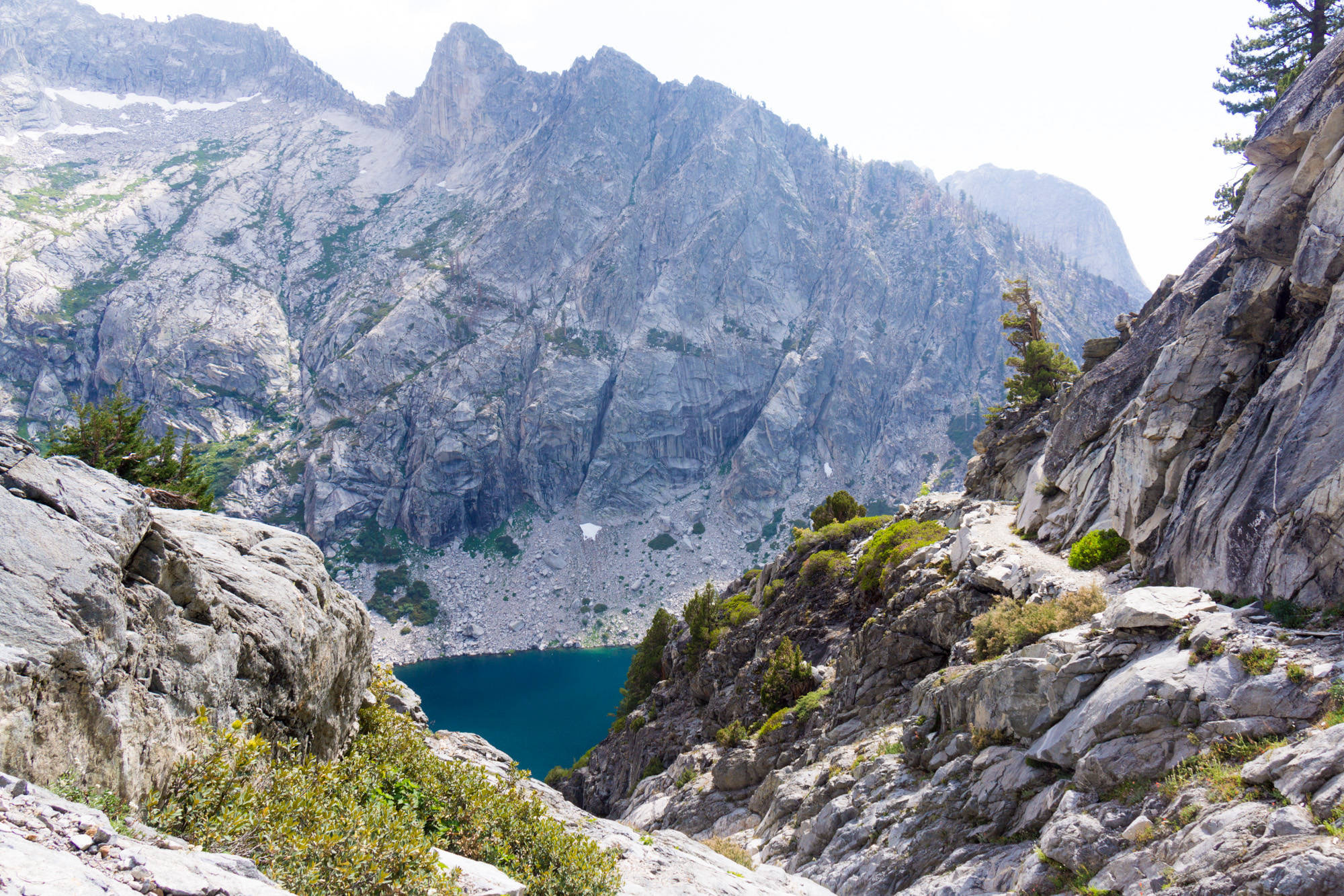 Looking back down at Hamilton Lake from the trail cut into the cliffs above.

 Some leftover snow from this past winter's record snowpacks.
 Some icebergs left in Precipice Lake.
 A surprisingly green meadow above Precipice Lake.
 Looking across into the Nine Lakes Basin from Kaweah Gap. This is where the High Sierra Trail was originally supposed to cross instead of taking a big jog down Big Arroyo and back up the Kern Canyon. The cost of blasting through even more granite cliffs dictated the "temporary" use of current route.


 Looking back up at Kaweah Gap.
 Heading down Big Arroyo.

Day 3 would take us from the old sheep herder's cabin in Big Arroyo, across the Chagoopa Plateau, and on our first descent down an unbelievable number of Sierra switchbacks (us New Hampshire folks prefer to hike straight up and down our mountains instead of zig zagging back and forth across them). This would put us in the Kern River canyon, back down in the thick air (relatively speaking) at 6,800'.

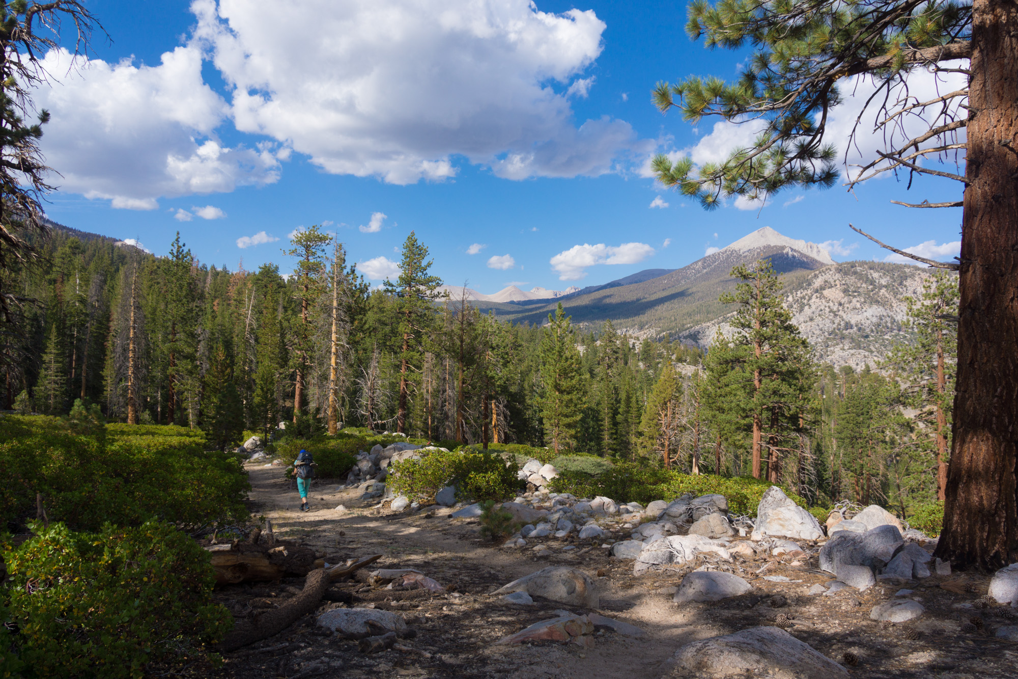
 Descending the switchbacks down into the Kern River Canyon.
Day 4 was spent hiking upstream along the Kern River on a slow gentle climb to 8,500'. With a relatively short 9 mile day this afforded us the opportunity to spend some time getting cleaned up at Kern Hot Springs.

Day 5 saw us start the long climb up out of the Kern River Canyon and on to Mt Whitney. The High Sierra Trail intercepts the John Muir Trail and Pacific Crest Trail just before we reached our camp for the night. After spending 4 days seeing only one or two other people during a whole day of hiking it was surprising running into 20 or so JMT hikers on the short stretch between Wallace Creek and Crabtree Meadow. The Meadow itself felt like a small village with all the hikers camped out along its margins.
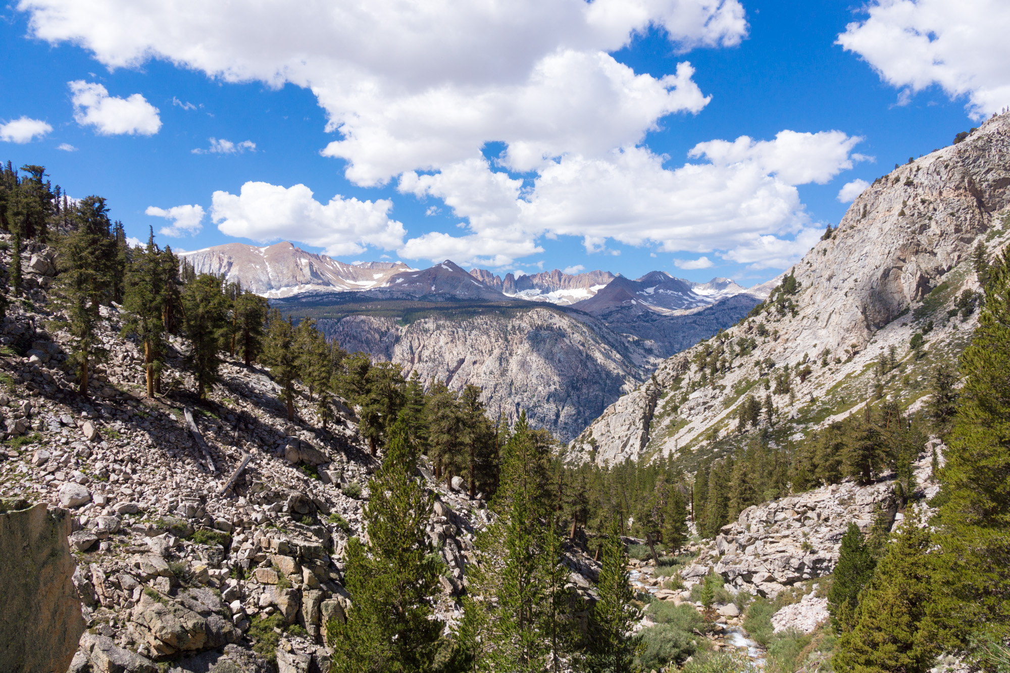 Looking back across at the Kaweah range, beyond which is Big Arroyo where we had just been 2 days earlier.


 Apparently there is an ad-hoc postal service along the John Muir Trail.
We took an easy day 6. With 3 days of food left to carry, the steep climb all the way up to Mt Whitney, and the mileage required to get back down to water on the other side we wanted to camp as high up as we could while giving ourselves a final chance to rest and adjust to the thin air. After spending the morning and most of the afternoon relaxing around our camp in Crabtree Meadow we hiked up to a little marshy lake above Guitar Lake, the last source of water along the trail. After a near miss from an ominous looking thunderstorm we settled in to prepare for an early start the next morning.


Summit day! We set out just after sunrise on day 7 to start the climb up to the trail junction just below Trail Crest where we could drop our heavy backpacks and take the 2 mile (each way) spur trail along the ridge to the summit.


There was some surprise activity during our climb up the switchbacks as a Park Service helicopter landed near where we had just broken camp and began offloading equipment. A few minutes later it took back to the air but this time with a rescuer hanging underneath. As we came around the last switchback before the trail junction we saw the reason why: a hiker on a day trip to the summit the previous day had run into trouble (a newspaper article I found later mentioned a combination of a diabetic episode and altitude sickness) and had spent a very cold night at 13,500' in an emergency blanket. Some hikers heading up to Whitney to catch the sunrise had come across him before sunrise and managed to call for help so a Park Service ranger had hiked all the way up and spent hours treating the victim until the sun came out and the helicopter could safely make a rescue.
 Landing Zone.
 Ready for a rescue.
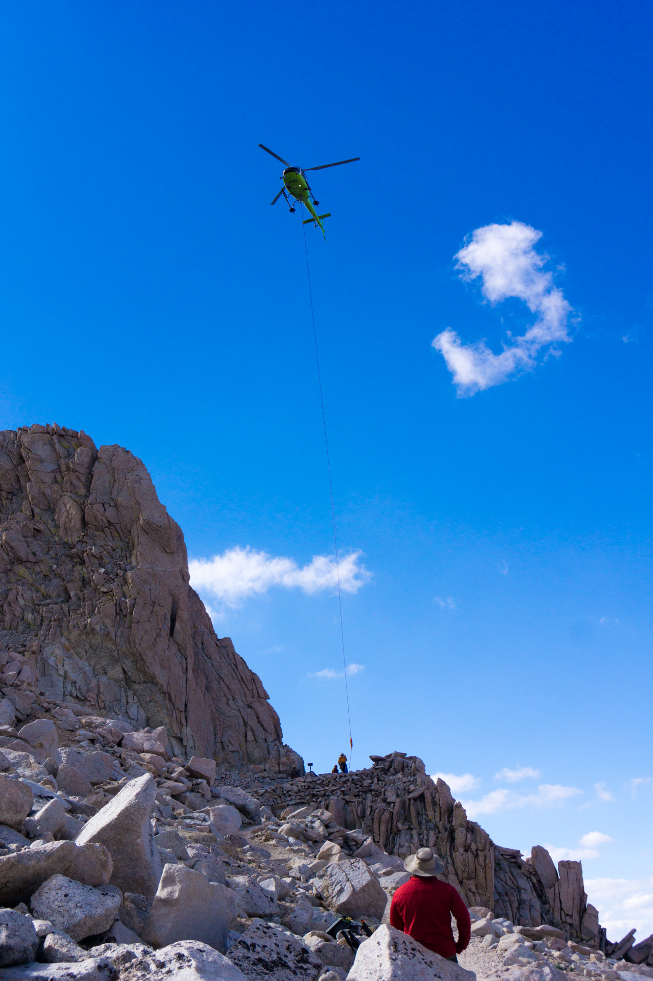 Making the pickup.
With the situation resolved, we carried on to the summit for a quick photo opportunity, back to our packs, and then over Trail Crest to start our descent back to Whitney Portal where we would end our trip and drive back down into the great desert formed by the rain shadow of the Sierras. If the number of hikers we ran into since joining the JMT was surprising, the crowds between the trail intersection, the summit, and Whitney Portal were downright shocking. There were absolute hordes of day and overnight hikers coming up the 12 mile trail from Whitney Portal. Our descent down the 99 switchbacks (I only counted 98) brought us to Trail Camp, the first water source when descending the East side, which was like a miniature city. Unfortunately it seemed to have some of the same issues as a city too with food wrapped shimmering just below the surface of the lake, rocks that all smelled like urinals, frat bros blasting music, and used wag bags (poop doesn't decompose at 12,000' so it's supposed to be packed out) stuffed in various crevices. I blame this gaggle of idiots for the strict permitting system and trailhead quotas in most of the western parks, the wilderness just can't handle this many people leaving such a mess in their wake. Although we had originally planned to spend the night at Trail Camp we still had plenty of daylight left, I had a headache coming on (likely from the altitude), and there was hot food, showers, and beds down in town. We made a break for it and ended up covering 15 miles that final day.
 Peeking between the pinnacles at the route we would soon be descending.
 The obligatory summit photo.
 A panorama of where we had come from.
 Looking back at the summit, much less majestic on the western side.
 A final look back at the Kaweahs, a similar photo I took 5 years earlier when I climbed Mt Whitney from the East was my inspiration to find out "what's out there". Now I know, because I've been there.
 Peeking between the pinnacles again.
 Some snow left on the east side as well in Trailside Meadow.
 Looking back down into the desert where our trip will soon end.
The trail itself was built in the 1930's after the original boundaries of Sequoia National Park were expanded to include Mt Whitney. There are no roads in this portion of the Sierras so, faced with a nearly 300 mile drive around the southern end of the park to get to the new attraction, the park service got to the task of building a trail straight across the range. This video explains a bit more of how the trail came to be.
Although this trail may be shorter than the other, more famous, long distance hiking trail that ends at Mt Whitney, the John Muir Trail, it holds the distinction of having a complete lack of resupply and bailout options. You have to bring everything you need for the whole journey and if something goes wrong your choices are to either head back however far you came, continue on in the direction you're going, or summon a very expensive emergency helicopter ride (more on that later).
Before you can get started hiking however, you need to arrange transport. In our case this meant me dropping a car at Whitney Portal near the eastern end of the trail. Rob and Steph, who have been living the RV life since the spring, were picking me up and driving us all to the trailhead, where we would start our hike, over in Sequoia National Park.
Instead of making Rob and Steph drive their motorhome up the steep and narrow road to Whitney Portal, made famous in The Long Long Trailer, I strapped on my pack and headed down Whitney Portal National Recreation Trail. This trail was originally part of the Mt Whitney Trail (to the summit) before the construction of Whitney Portal Road allowed summertime hikers access higher up. It still sees use for summit attempts when the road is closed for the winter. This isn't to say the trail isn't worth hiking on its own merits: the rapid transition from the forest environment of Whitney Portal to the desert ecosystem at the Lone Pine Campground at the other end of the trail is a sight to see.
 A small waterfall near the upper end of Whitney Portal Trail
 Looking back up along Whitney Portal Trail at Mt Whitney itself from the desert brush.
After 2 days of car shuttling we were finally ready to start on our hike from Crescent Meadow in Sequoia National Park. The first day would be about 12 mostly level miles with a final climb up to the tent hotel at Bearpaw Meadow where some very habituated deer wander around the backpacker campsites.
 Crescent Meadow trailhead
 Sequoia tree near the trailhead.
 Eagle View, our first glimpse of what we were about to do.
Looking back past Moro Rock and down at California's central valley.


Our second day would take us another 12 miles from Bearpaw Meadow over the Kaweah Gap and into Big Arroyo. This required climbing all the way up from 8,500' to 10,700' before dropping back down to 9,500' on the other side. We spent most of the day looking up at the enormous wall of granite in front of us that we would take us until evening to cross.
 The view from the porch at Bearpaw Meadow.
 Our first look at the route ahead of us over Kaweah Gap.


 Hamilton Lake, quite possibly the most beautiful camping spot I've ever seen. Unfortunately we still had many miles to go that day.
 Looking back down at Hamilton Lake from the trail cut into the cliffs above.
 Some leftover snow from this past winter's record snowpacks.
 Some icebergs left in Precipice Lake.
 A surprisingly green meadow above Precipice Lake.
 Looking across into the Nine Lakes Basin from Kaweah Gap. This is where the High Sierra Trail was originally supposed to cross instead of taking a big jog down Big Arroyo and back up the Kern Canyon. The cost of blasting through even more granite cliffs dictated the "temporary" use of current route.

 Looking back up at Kaweah Gap.
 Heading down Big Arroyo.
Day 3 would take us from the old sheep herder's cabin in Big Arroyo, across the Chagoopa Plateau, and on our first descent down an unbelievable number of Sierra switchbacks (us New Hampshire folks prefer to hike straight up and down our mountains instead of zig zagging back and forth across them). This would put us in the Kern River canyon, back down in the thick air (relatively speaking) at 6,800'.


 Descending the switchbacks down into the Kern River Canyon.
Day 4 was spent hiking upstream along the Kern River on a slow gentle climb to 8,500'. With a relatively short 9 mile day this afforded us the opportunity to spend some time getting cleaned up at Kern Hot Springs.

Day 5 saw us start the long climb up out of the Kern River Canyon and on to Mt Whitney. The High Sierra Trail intercepts the John Muir Trail and Pacific Crest Trail just before we reached our camp for the night. After spending 4 days seeing only one or two other people during a whole day of hiking it was surprising running into 20 or so JMT hikers on the short stretch between Wallace Creek and Crabtree Meadow. The Meadow itself felt like a small village with all the hikers camped out along its margins.
 Looking back across at the Kaweah range, beyond which is Big Arroyo where we had just been 2 days earlier.

 Apparently there is an ad-hoc postal service along the John Muir Trail.
We took an easy day 6. With 3 days of food left to carry, the steep climb all the way up to Mt Whitney, and the mileage required to get back down to water on the other side we wanted to camp as high up as we could while giving ourselves a final chance to rest and adjust to the thin air. After spending the morning and most of the afternoon relaxing around our camp in Crabtree Meadow we hiked up to a little marshy lake above Guitar Lake, the last source of water along the trail. After a near miss from an ominous looking thunderstorm we settled in to prepare for an early start the next morning.


Summit day! We set out just after sunrise on day 7 to start the climb up to the trail junction just below Trail Crest where we could drop our heavy backpacks and take the 2 mile (each way) spur trail along the ridge to the summit.


There was some surprise activity during our climb up the switchbacks as a Park Service helicopter landed near where we had just broken camp and began offloading equipment. A few minutes later it took back to the air but this time with a rescuer hanging underneath. As we came around the last switchback before the trail junction we saw the reason why: a hiker on a day trip to the summit the previous day had run into trouble (a newspaper article I found later mentioned a combination of a diabetic episode and altitude sickness) and had spent a very cold night at 13,500' in an emergency blanket. Some hikers heading up to Whitney to catch the sunrise had come across him before sunrise and managed to call for help so a Park Service ranger had hiked all the way up and spent hours treating the victim until the sun came out and the helicopter could safely make a rescue.
 Landing Zone.
 Ready for a rescue.
 Making the pickup.
With the situation resolved, we carried on to the summit for a quick photo opportunity, back to our packs, and then over Trail Crest to start our descent back to Whitney Portal where we would end our trip and drive back down into the great desert formed by the rain shadow of the Sierras. If the number of hikers we ran into since joining the JMT was surprising, the crowds between the trail intersection, the summit, and Whitney Portal were downright shocking. There were absolute hordes of day and overnight hikers coming up the 12 mile trail from Whitney Portal. Our descent down the 99 switchbacks (I only counted 98) brought us to Trail Camp, the first water source when descending the East side, which was like a miniature city. Unfortunately it seemed to have some of the same issues as a city too with food wrapped shimmering just below the surface of the lake, rocks that all smelled like urinals, frat bros blasting music, and used wag bags (poop doesn't decompose at 12,000' so it's supposed to be packed out) stuffed in various crevices. I blame this gaggle of idiots for the strict permitting system and trailhead quotas in most of the western parks, the wilderness just can't handle this many people leaving such a mess in their wake. Although we had originally planned to spend the night at Trail Camp we still had plenty of daylight left, I had a headache coming on (likely from the altitude), and there was hot food, showers, and beds down in town. We made a break for it and ended up covering 15 miles that final day.
 Peeking between the pinnacles at the route we would soon be descending.
 The obligatory summit photo.
 A panorama of where we had come from.
 Looking back at the summit, much less majestic on the western side.
 A final look back at the Kaweahs, a similar photo I took 5 years earlier when I climbed Mt Whitney from the East was my inspiration to find out "what's out there". Now I know, because I've been there.
 Peeking between the pinnacles again.
 Some snow left on the east side as well in Trailside Meadow.
 Looking back down into the desert where our trip will soon end.
- Acadia National Park
- Adirondacks
- Aerial
- Airstream
- Ancient Bristlecone Pines
- Anza-Borrego
- Appalachian Trail
- Arches National Park
- Backpacking
- Bad Larry
- Bears Ears National Monument
- Boatpacking
- Boston
- Bryce Canyon National Park
- Canoeing
- Canyon de Chelly National Park
- Canyoneering
- Canyonlands National Park
- Capitol Reef National Park
- Caribbean
- Catskills
- Cities
- Climbing
- Colorado National Monument
- Colorado Plateau
- Death Valley National Park
- Europe
- Fisher Towers
- Grand Canyon National Park
- Grand Staircase-Escalante National Monument
- Grand Teton National Park
- Gunks
- Hiking
- Iceland
- Joshua Tree National Park
- Lassen Volcanic National Park
- Manzanar National Historic Site
- Mojave Desert
- Mojave National Preserve
- Mountaineering
- Mt Washington
- Mt Whitney
- Natural Bridges National Monument
- New York CIty
- Pacific Northwest
- Petrified Forest National Park
- Pinnacles National Monument
- Red Roamer
- Road Trips
- Rocky Mountains
- Ruins
- Sailing
- San Diego
- San Francisco
- Sequoia National Park
- Sierra Nevada
- Skiing
- Sonora Desert
- Spelunking
- Superbloom
- Superstition Mountains
- White Mountains
- Yellowstone National Park
- Yosemite National Park
- Zion National Park