Chris Roams
Travel, Adventures, and Photography
The Spaces Inbetween
December 19, 2011
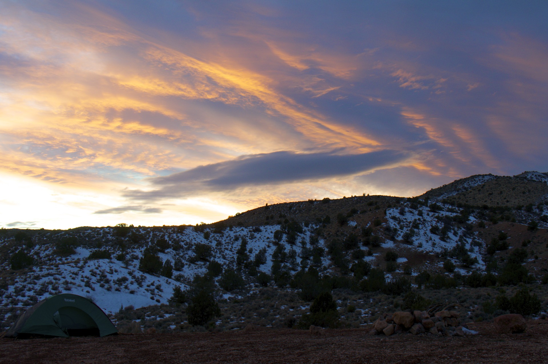
Following yesterday’s adventures at The Wave I cooked up some dinner, was treated to a nice sunset, and very shortly thereafter turned in to bed. There’s not much to do after dark and Wire Pass is a few thousand feet above sea level so it’s best to warm up the sleeping bag early.
The down side of going to bed at 8pm is being wide awake with a full night’s sleep at 3am. I wandered around in the moonlight for a bit, stared at the ceiling of the tent worrying about the road conditions, and wondered about the weather forecast I saw on the way in predicting a 20% chance of precipitation that coming day. Once in a while the wind would pick up, the stars would disappear and I would worry that it was the start of a snowstorm but just as I had almost convinced myself that I should immediately pack up and make my escape by moonlight the wind stopped and the stars would come back out. After a few hours of this I finally gave up worrying and dozed off until sunrise. And then it started snowing…
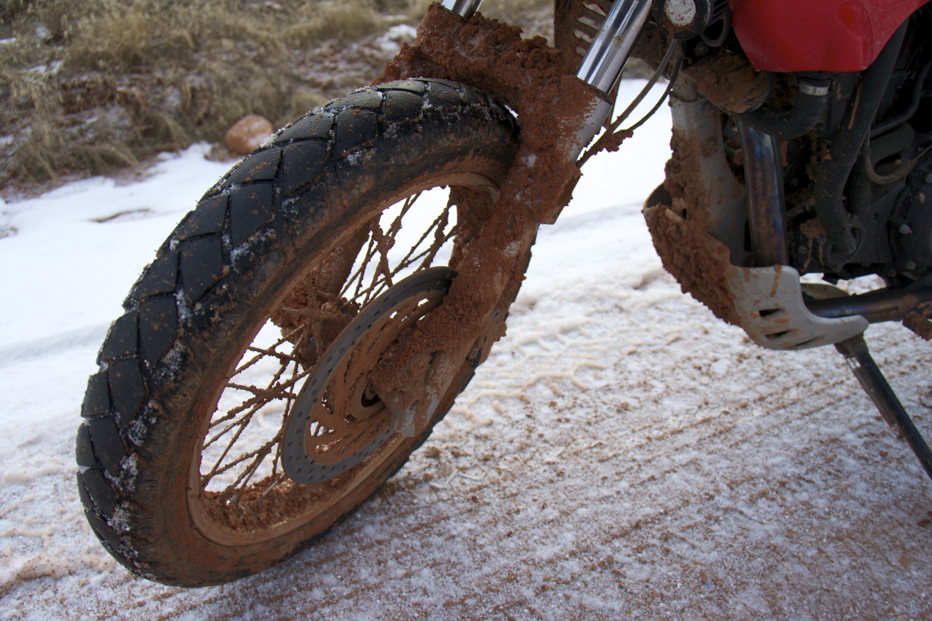
I got up with the sun and could see it coming, blocking out the distant cliffs in a featureless white veil, slowly working its way west across the ridges. Breakfast was forgone in favor of getting on the road while the getting was still good and the first snowflakes arrived on the site of my former camp just as I was starting the bike. Snow aside, the road was thoroughly frozen and the previous difficulties were non-existent. What had been the worst patches of snotty muck, which required paddling along with feet on the ground on the way in, were now solidified to the consistency of ground up Oreo cookies. By riding in the deep tire tracks that had been left by the trucks traveling out before the clay froze it was even possible to have a smooth ride. The tracks were so deep and steep-sided that riding in them was probably unavoidable anyways as they would capture the bike’s wheels forcing it wherever they went. With a little practice it was easy enough to switch from one set of tracks to another wherever they crossed like a train switching tracks. In a few spots I even dared switch up to second gear before hastily switching back down again after cresting a hill (the north-facing slopes receive little sunlight and presented the risk of ice hidden under the dusting of snow). The hours-long ride in was reduced to a mere 30 minutes on the way out.
Upon reaching the paved road I aired the tires back up with a tiny air compressor I picked up in Moab and decided that I had seen enough of Kanab, it was time for some new scenery and seeing as the road only went to 2 places (Kanab and Page, AZ) I turned towards Page and the Glen Canyon Dam with the plan of continuing south to Flagstaff. Unfortunately when I arrived at the Glen Canyon Dam my first chance to connect back to the world revealed that more snow was in the forecast for the entire region and that the flurries that had followed me to Page was not an isolated dusting but the outlying front of a larger storm system hovering north of Kanab threatening to sweep down onto the road blocking escape back the way I came. I would not be able to continue south to Flagstaff, I needed to get off the Colorado Plateau to the lower elevations to the west. There are only 2 road crossings of the Colorado River between Moab and the Hoover Dam, a distance of 335 miles as the crow flies but closer to 500 miles by road: Route 89 from Kanab and the bridge over Glen Canyon was the one I had just come across and the other was Route 89A, through the House Rock Valley and across the older crossing at Marble Canyon, both at much lower elevations than Page or the road back to Kanab. The only problem with this route it then climbs straight over the backbone of the Kaibab Plateau, the same formation that makes up the North Rim of the Grand Canyon, at an elevation of nearly 8,000 feet. A quick call to the only lonely outpost in that part of the world (a combination gas station, motel, and restaurant located where the road to the North Rim splits off) revealed that the road was clear and so my course was set. Before leaving I stopped by the gift shop at the dam and noticed that they carried various books by Ed Abbey (who, as I noted in a previous post, was very critical of the dam and everything it stood for) although they did not carry The Monkey Wrench Gang (Abbey’s work of fiction about a trio of characters who fantasize about destroying the dam but, lacking the means to carry out their fantasies, instead resort to sabotaging bulldozers and anything else they perceive as destroying their desert paradise). I inquired as to the missing volume and received the stern reply that “Some books we just won’t carry. We are about interpretation and some of the books we carry are critical of the dam.” It’s too bad, if they had it I would have bought it there just for the irony.
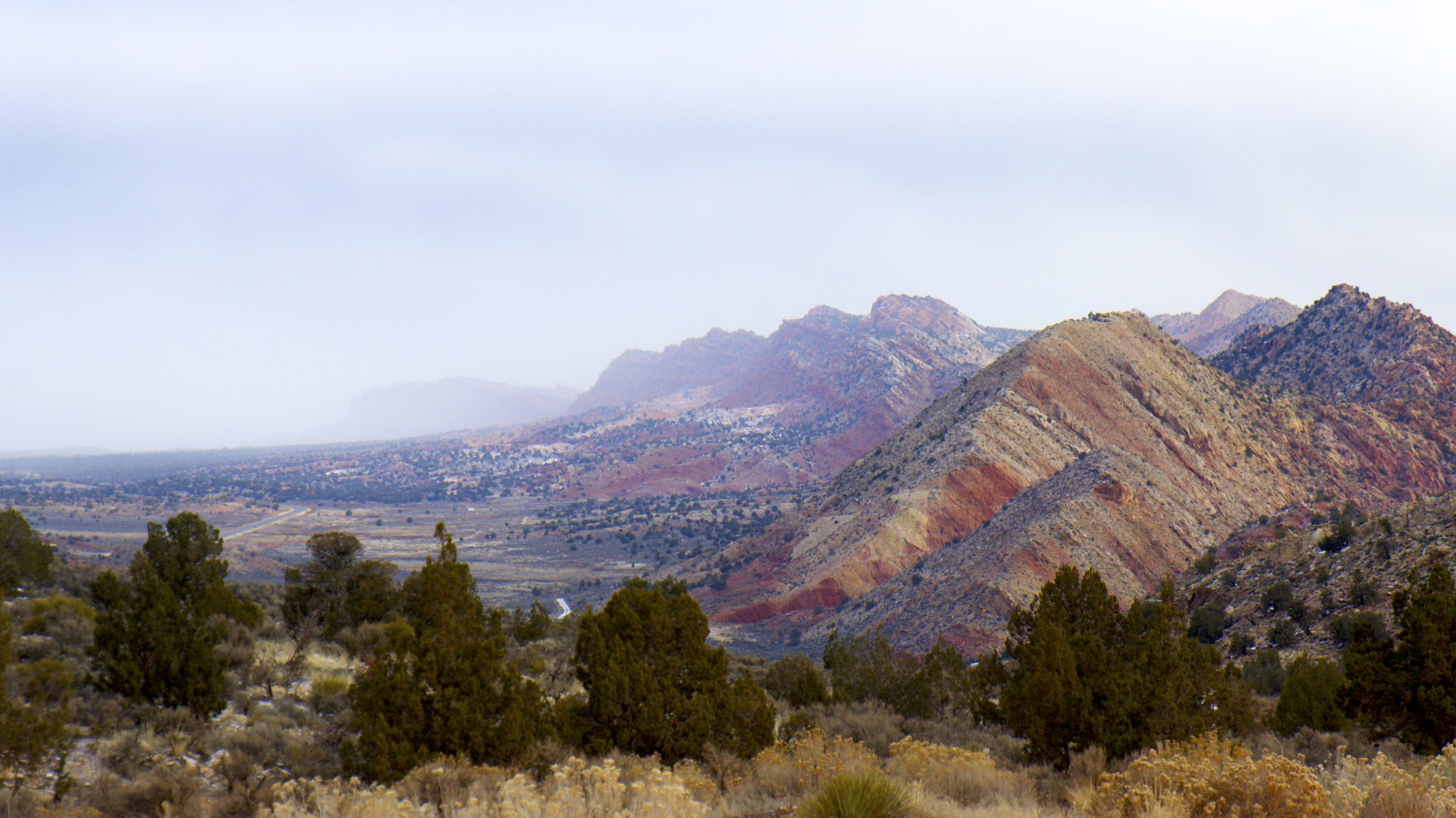
With the exception of the Kaibab National Forest up in the mountains the area that this route crosses through is not part of any National Park or Designated Wilderness Area. It is simply land; some owned by the Navajo, some private, and some public. That said, it is just as scenic as anything in a national park. The road down off the plateau into House Rock Valley affords enormous views of the broad valley floor 1,200 feet below and the Marble Canyon, carved out by the Colorado River hacking its way through the sandstone a further 2,000 feet below the valley floor on its way into the Grand Canyon. The tallest building in the world, the Burj Khalifa could be dropped in the bottom of Marble Canyon and its top floor would just barely peak out above the valley floor, its antenna spire would still be 500 feet short of the plateau above. The low clouds scudding along the cliffs made for some scenery in the overcast and had I not been fleeing the snow I would have liked to spend more time exploring here.
Soon enough I was over the mountains and looking down on yet another valley, this one containing Kanab and the road west to Hurricane, Interstate 15, and Las Vegas. A few weeks ago I passed through this same area on my way to Las Vegas and stopped at the top of the last set of cliffs before the highway to set up my tripod and take a parting picture of myself, one of the few that I have (one of the quirks of traveling alone is that you end up with pictures of just about everything except yourself). That time I was in a hurry to get to Las Vegas before sundown but now, having evaded the storm and broken back out into blue skies, I had all the time in the world. I stopped at the same spot to take stock in my situation and plan my next move only to discover a jeep trail heading back along the cliffs. I took the opportunity to head out and try to get a shot of the valley floor with the mountains in the background. This trail was hard-packed. No clay, no ice, no sand, no snow. Blasting through the washouts and looping through the banked corners at the back of the gullies on the cliff’s edge helped me rediscover why I’m doing this trip on a motorcycle, something that was sorely needed after the slog in to The Wave and the subsequent flight from snow. The sun was going down however and soon enough I had to call it quits and drop down to the highway, headed for Las Vegas (all roads lead to Vegas in this part of the country).
Pulling off the highway a few miles short of Las Vegas (if you can consider 50 miles “a few”) I dropped onto Northshore Road, a bit of pavement through Lake Mead National Recreation Area that twists and turns through the hills a few miles back from the lakeshore, eventually dropping back into the civilized world southeast of Las Vegas. After passing the few little towns near the highway the speed limit climbs to 50 miles per hour, a speed that is probably reasonable during the day but seems ludicrous in the dark. The road must have been recently paved as the asphalt was nearly flawless and the reflectors installed on the centerline shone back like spotlights. The pavement itself was as black and featureless as whatever lay beyond its edges, all blending together to leave just the oncoming stream of reflective dots to show the way. Although it was only a little after 7pm I had the road to myself, twisting through the hills and once again remembering why 2-wheeled vehicles exist.
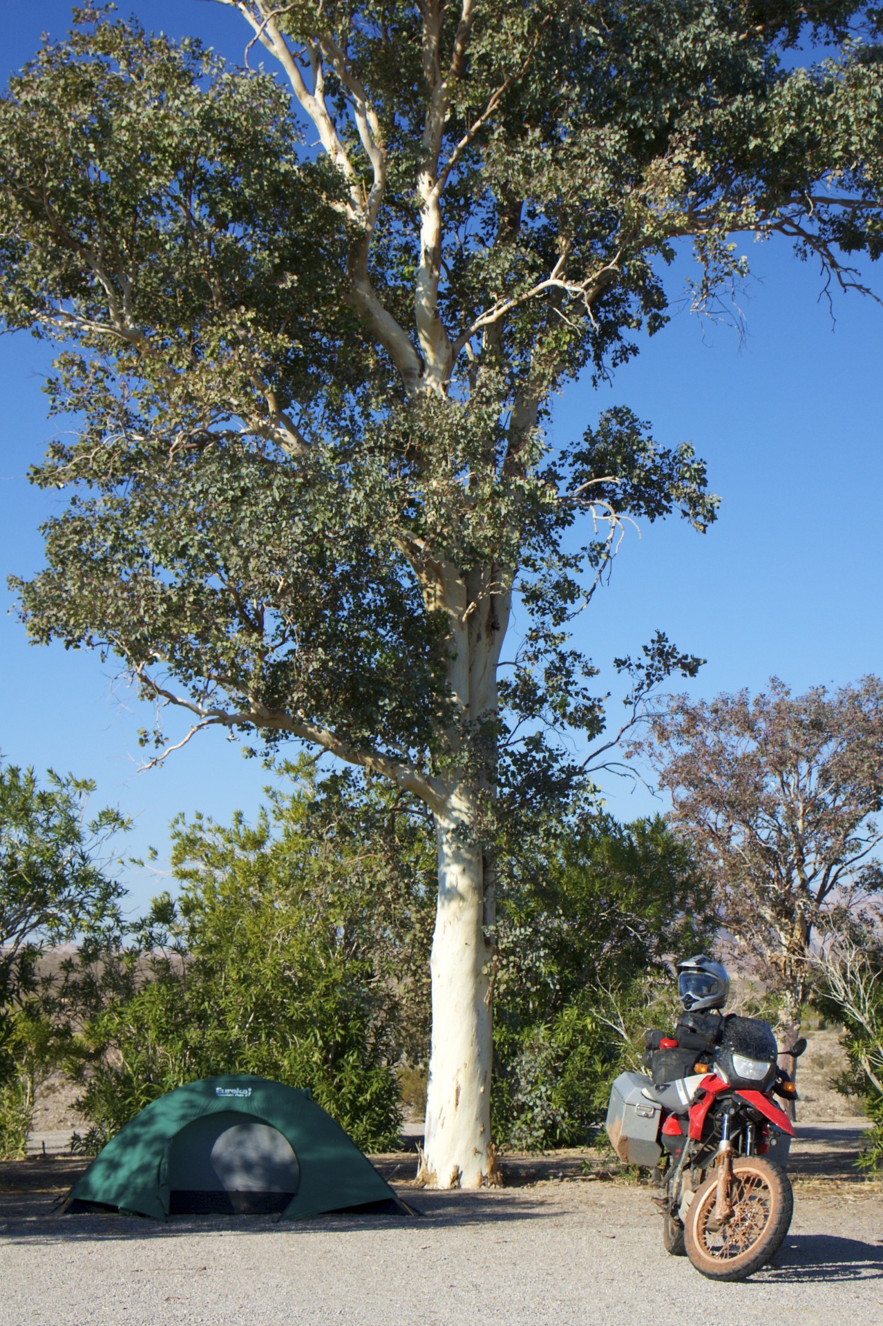
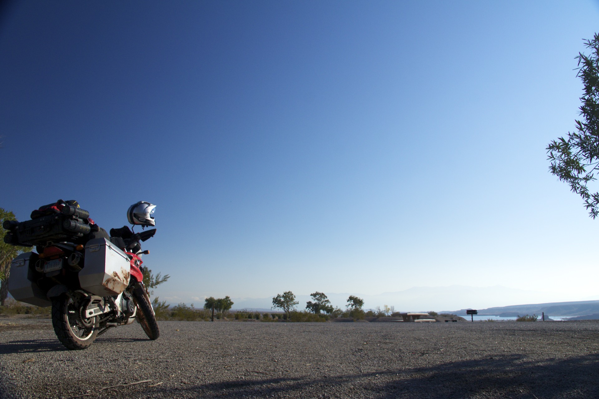
I eventually settled in to camp on Las Vegas Bay, the arm of the lake that used to be Las Vegas Wash before the dam was built. It looked like this campground was for tents only but upon arrival it was immediately obvious that although there were no hook-ups it was flooded with motorhomes and trailers, and that I would be pitching my tent on the usual National Park Service gravel camp site. I chose as remote a site as I could, at the far end of the campground. The moon wasn’t up yet and it was still entirely too dark to see more than a few feet although I could tell that I was standing on a peninsular height of land, with a steep drop on 3 sides down into inky blackness and a vast open distance in front of me. Perhaps I had found the edge of Lake Mead and would wake up to a waterfront view. I settled in to my tent and would have to wait until morning to find out.
When the sun came up and I looked out my tent door I saw nothing but an empty wasteland where the lake once was. I’m fairly sure the lake’s waters once reached to the bottom of this little peninsula but now its waters were a mile distant. Off to the south across the dry “bay” was a marina, high and dry with its boat-launch ramp now just an enormous slab of concrete trailing off into the rocky desert rather than water, falling 100 yards short of a little creek winding its way down to the lake. I wonder what people will think of these places eons from now when the lake is gone.
As for me, I am retreating to Las Vegas to get a few days work in and plan my next move. The logical choice from here is Death Valley before heading south to warmer climes.


- Acadia National Park
- Adirondacks
- Aerial
- Airstream
- Ancient Bristlecone Pines
- Anza-Borrego
- Appalachian Trail
- Arches National Park
- Backpacking
- Bad Larry
- Bears Ears National Monument
- Boatpacking
- Boston
- Bryce Canyon National Park
- Canoeing
- Canyon de Chelly National Park
- Canyoneering
- Canyonlands National Park
- Capitol Reef National Park
- Caribbean
- Catskills
- Cities
- Climbing
- Colorado National Monument
- Colorado Plateau
- Death Valley National Park
- Europe
- Fisher Towers
- Grand Canyon National Park
- Grand Staircase-Escalante National Monument
- Grand Teton National Park
- Gunks
- Hiking
- Iceland
- Joshua Tree National Park
- Lassen Volcanic National Park
- Manzanar National Historic Site
- Mojave Desert
- Mojave National Preserve
- Mountaineering
- Mt Washington
- Mt Whitney
- Natural Bridges National Monument
- New York CIty
- Pacific Northwest
- Petrified Forest National Park
- Pinnacles National Monument
- Red Roamer
- Road Trips
- Rocky Mountains
- Ruins
- Sailing
- San Diego
- San Francisco
- Sequoia National Park
- Sierra Nevada
- Skiing
- Sonora Desert
- Spelunking
- Superbloom
- Superstition Mountains
- White Mountains
- Yellowstone National Park
- Yosemite National Park
- Zion National Park