Chris Roams
Travel, Adventures, and Photography
A Tough Life in Paradise
December 26, 2011
Supai, Arizona, the home of the Havasupai Tribe, population 600, is a long ways from anywhere. The town is 8 miles down a mule path into the Grand Canyon from the nearest road, on which it is 60 miles to the next town: Peach Springs, home of the Hualapai Tribe but not home to a gas station (you have to drive another 7 miles and get off the reservation for that), from which it is another 60 miles to the closest interstate. That’s a 240 mile round trip drive into the middle of nowhere (not counting the 16 mile round trip by foot/mule/helicopter/jetpack/whatever) so this is not a place for the casual tourist.
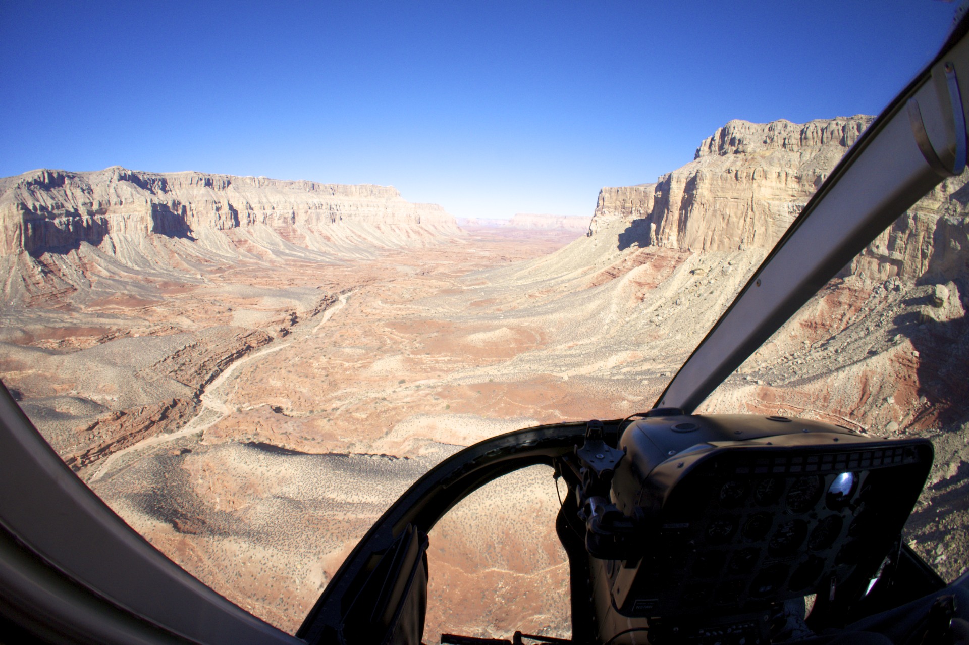
Hualapai and Cataract canyons converge just upstream from Supai, forming Havasu Canyon which continues all the way down to the Colorado River as it winds its way through the Grand Canyon. The tribe has lived in and around these canyons for 800 years, summering below the rim and wintering up on the plateau, until silver was discovered in their territory and in 1882 the federal government decreed all of the land on the plateau to be public thereby officially confining the tribe to 518 acres in Cataract Canyon. Numerous drift mines can be found up and down the walls of Havasu Canyon from various mining operations over the years. In 1908 the tribe suffered yet another setback when Theodore Roosevelt created Grand Canyon National Monument, a portion of which consisted of the tribe’s “former” land. As Grand Canyon was upgraded to National Park status the Park Service began efforts to remove the tribe, whose population had been cut in half from historical numbers, and add the final 518 acres to the park. The tribe fought back (in the courts) and by 1975 was able to gain back the title or access to 250,000 acres. Today the tribe grazes cattle up on the plateau and lives in the village of Supai down in the canyons. Despite (or perhaps in part because of) their remote location the tribe now makes a significant income from tourists ($35 just to enter the reservation, plus camping or lodge fees). Unlike their neighbors the Hualapai who live up on the plateau and are responsible for constructing the Grand Canyon Skywalk to attract tourists the Havasupai possess a canyon full of natural wonders.
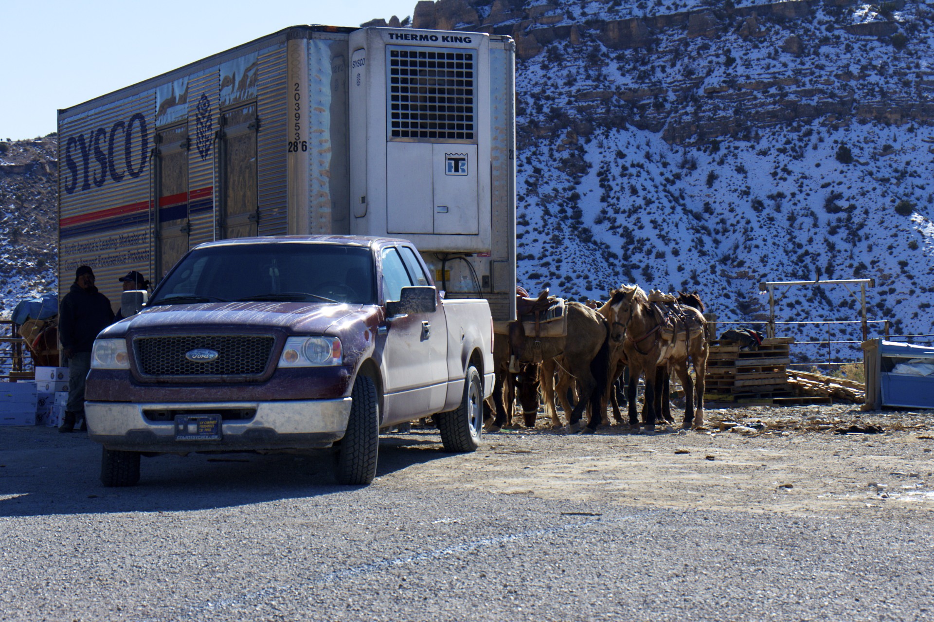
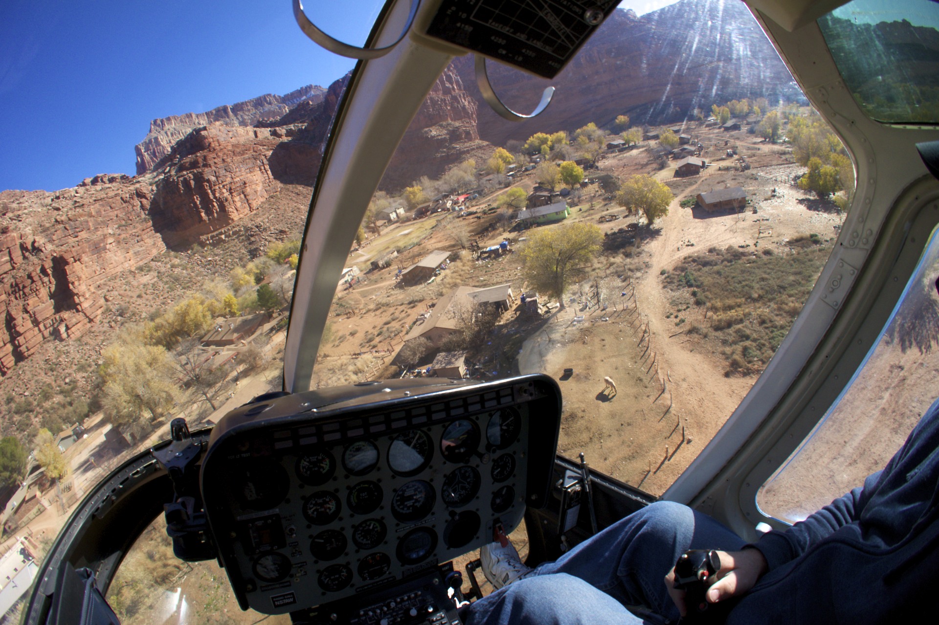
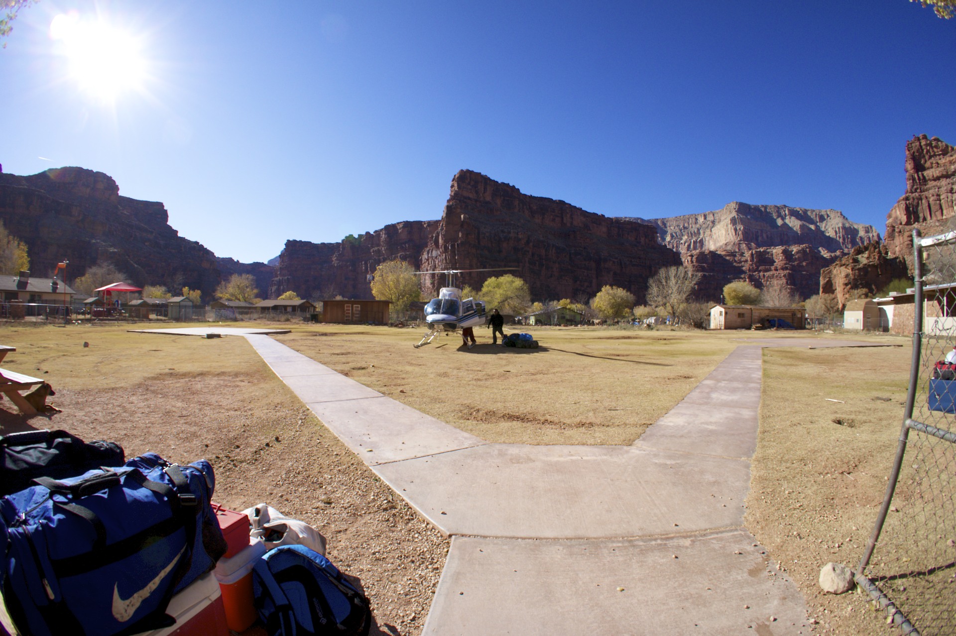
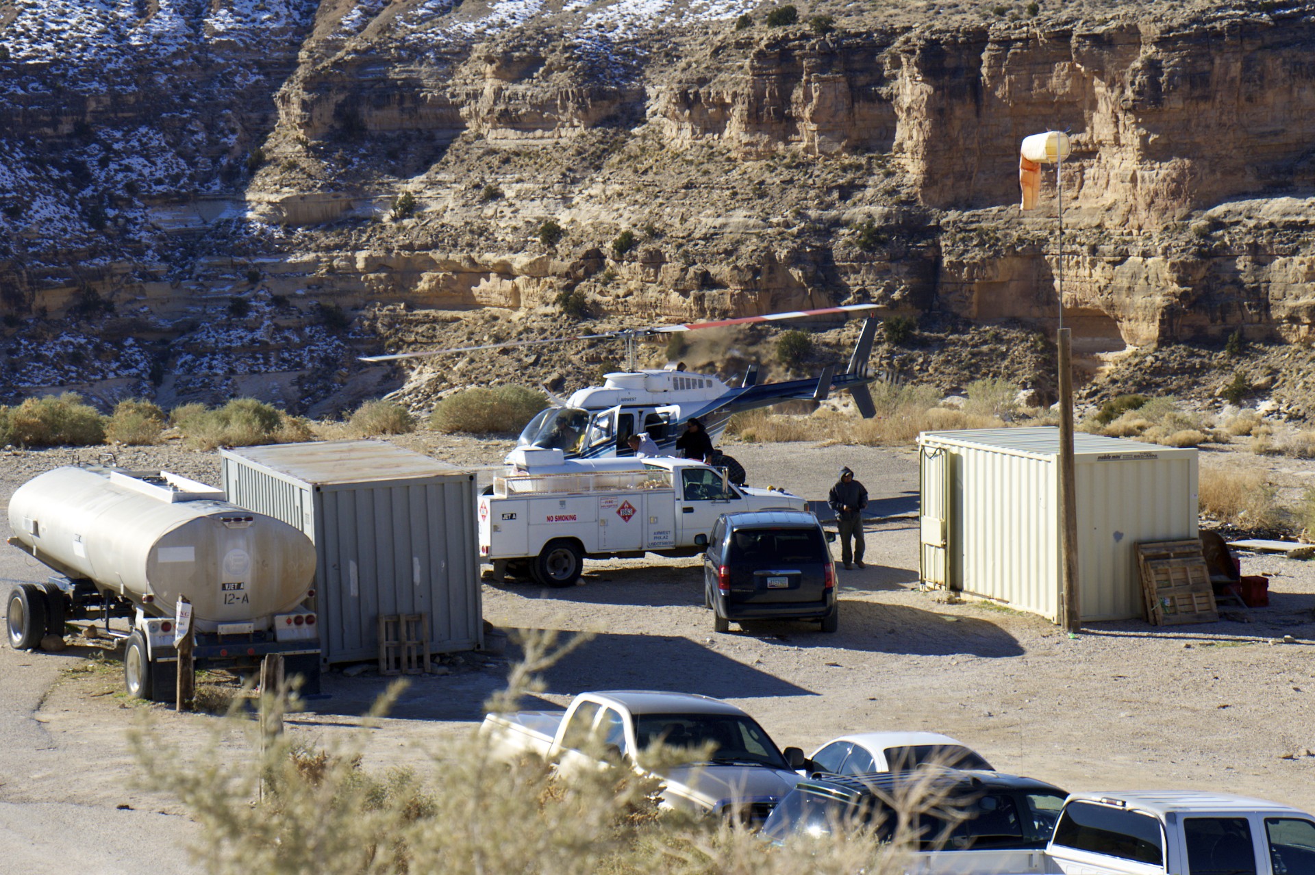
I arrived at Hualapai Hilltop, the parking lot at the end of Indian Road 18 and the start of the mule trail to Supai, early Friday afternoon; bit later than expected as I spent too much time at Hoover Dam earlier in the day and there was no way I was going to try crossing 120 miles of open range in the pitch dark (no moon at the moment). Despite its remote location the hilltop is a flurry of activity: it acts as the depot for all goods moving into or out of Supai, 8 miles and 2,000 feet below in the canyon. When I arrived a mule train was loading up next to a refrigerated trailer, pickup trucks full of wood and hay were shuttling their cargos back and forth between the hilltop and the plateau above, and a JetRanger packed full of cargo and carrying crates slung underneath would drop down into the canyon and return to disgorge a load of passengers and their luggage only to repeat the cycle all over again. Given the distance of the hike I would be arriving at Supai around sundown and the campground is another 2 miles beyond that so rather than stumble around an unfamiliar canyon full of treacherous cliffs in the dark I opted for the quick way down and hitched a ride on the heli. No TSA on this flight: toss my backpack in the cargo compartment, hop in the front seat next to the pilot and off we went. I even had my own set of controls, you don’t get that on American Airlines.
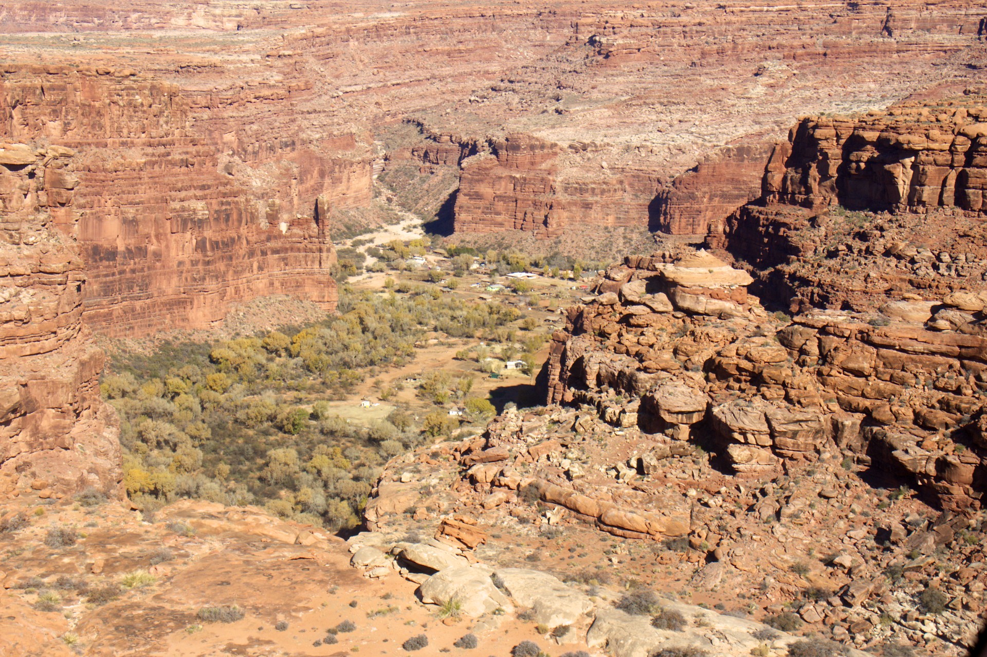
The town itself, well, I’m not sure if it looks more like something leftover from the 1800′s or an isolated outpost that survived the apocalypse. I suppose the second is more accurate as this town has had its share of apocalypses. Besides the hardships put on the tribe by the government and encroaching settlers in the previous century this canyon has a history of violent flooding, perhaps one of the reasons the tribe wintered on the plateau in past times. The town already had to be moved to a wider part of the canyon, hopefully less prone to flooding. Floods in 2008 forced the closure of the canyon to visitors as the tribe attempted to rebuild only to have more flooding in 2010 destroy the repairs, it only reopened a few months ago. The streets are all dirt as the primary mode of transportation (other than foot) is pony, although one quickly and repeatedly notices that ponies and mules have emissions of their own: unlike motor vehicles theirs are sometimes liquid and sometimes solid. As far as I could tell none of the streets, if they can be called that, were named. Not much of a point I suppose when most of the “downtown” area can be seen from a single spot and I’m sure all of the residents know where each other live. There are a few significant buildings in town like the schools (I suspect built with federal grants) and the church (a quonset hut with a stone facade), but the store, cafe, and most of the homes appear to have been cobbled together out of whatever was available: some resembling mobile homes although they didn’t appear to be prefabricated, others just ramshackle collections of lumber and plywood. The 2 main bridges out of the village were well-built but after leaving the main village area and crossing into the campground the engineering took a turn for the rudimentary: most of the “bridges” were just planks set on top of rocks, although the fancy composting pit toilets that the National Park Service is so fond of are sprinkled liberally around the campground and as usual they are made out of enormous slabs of concrete (note: in case of apocalypse, use toilet as bunker). The ubiquitous graffiti (mostly within the village itself) and trash (definitely not confined to the village) just adds to the post-apocalyptic effect. I didn’t take too many pictures inside the village as it just didn’t feel right to be snapping pictures when things appear to be in such bad shape here. To be fair this is my first time in the canyon and I don’t know how much of the ramshacklery is just fallout from the flooding and how much is “usual”. It’s entirely possible that the trash scattered throughout the canyon was dispersed during the flooding and that the town is still recovering, or maybe this is just the way they like it, I don’t know.
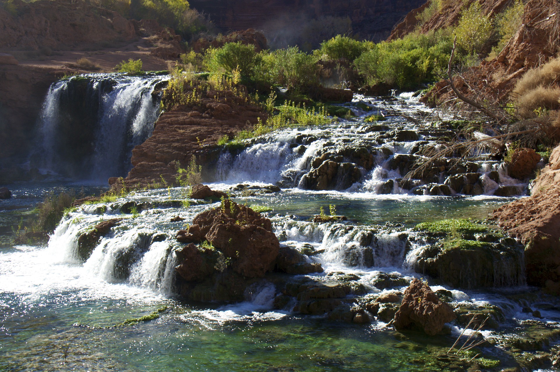
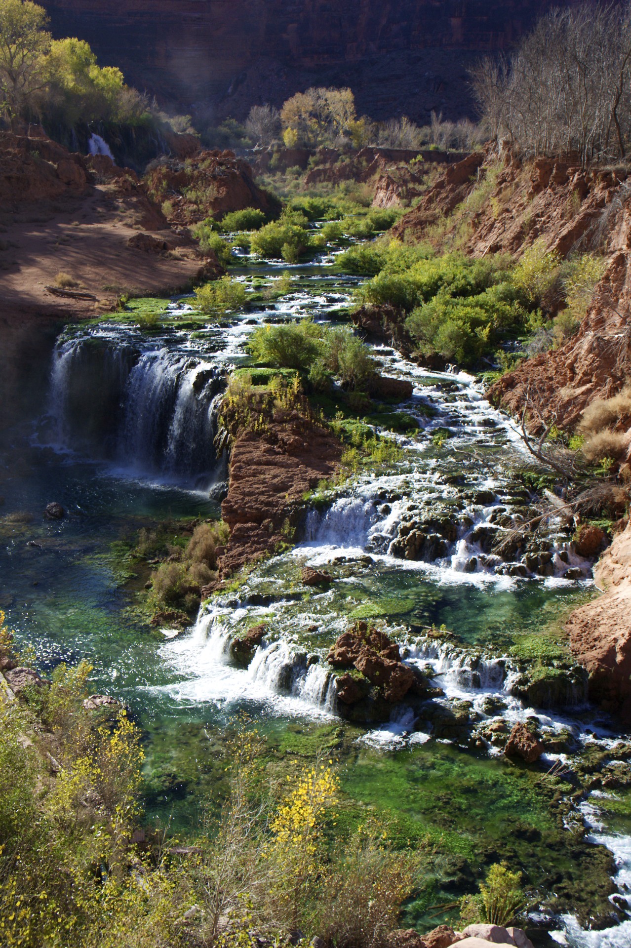
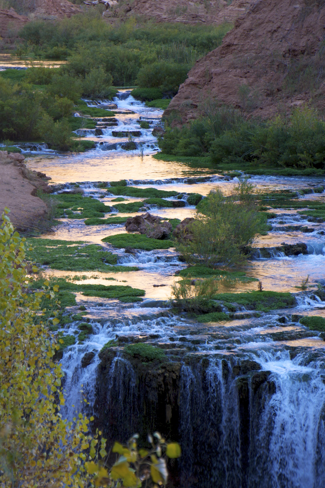
After passing downstream (to the north) out of the village the creek (and the parallel trail) starts cutting deeper through the sandstone, the first cliff was the former site of Navajo Falls which has been completely rearranged due to the flooding. What was the single Navajo Falls has now been divided into 2 sets of waterfalls: New Navajo and Rock Falls. The creek below these falls has hacked out a deep rough gash in the dirt, obviously unstable and very likely to change again with the next floods. All along the newly reconstructed trail (still showing the tracks from the skid-steers that helped construct it) there is evidence of former flows reminding the hiker that this section of trail, 20 feet above the water, used to be the main creek bed a very short time ago.
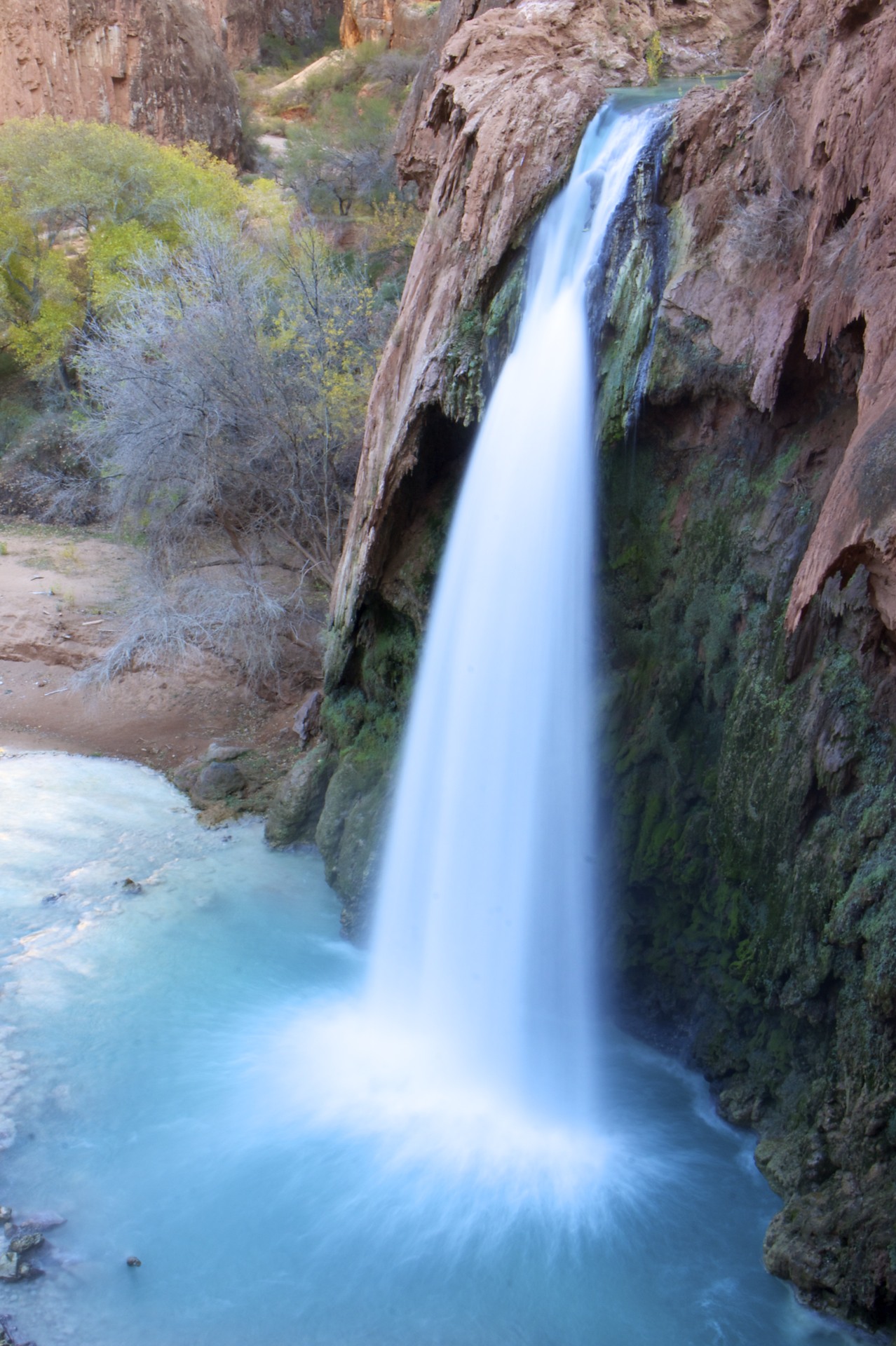
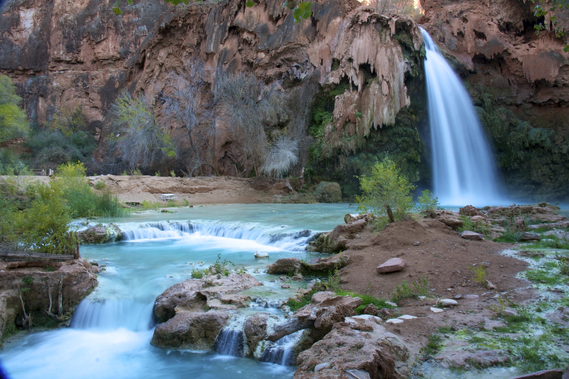
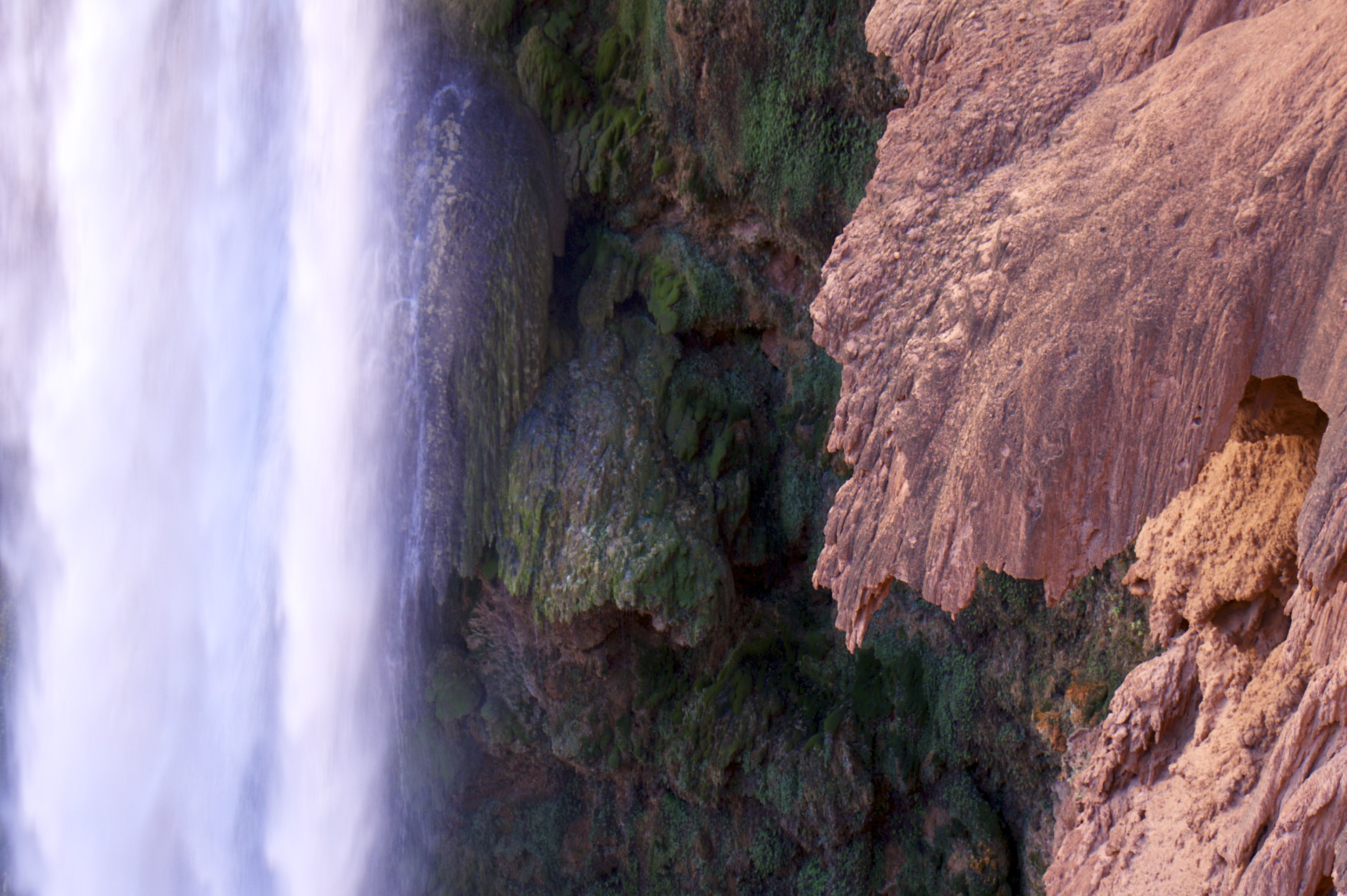
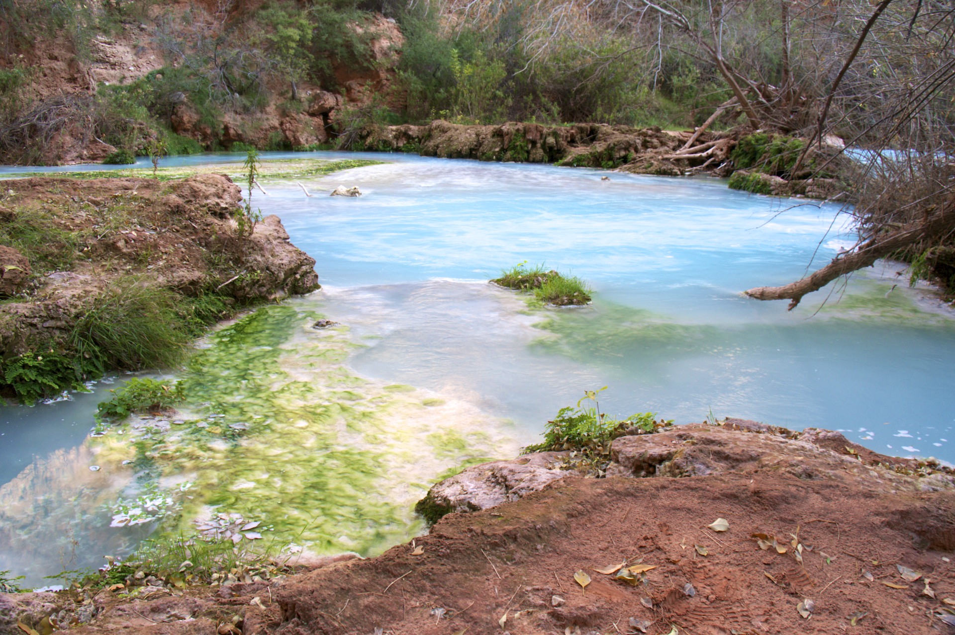
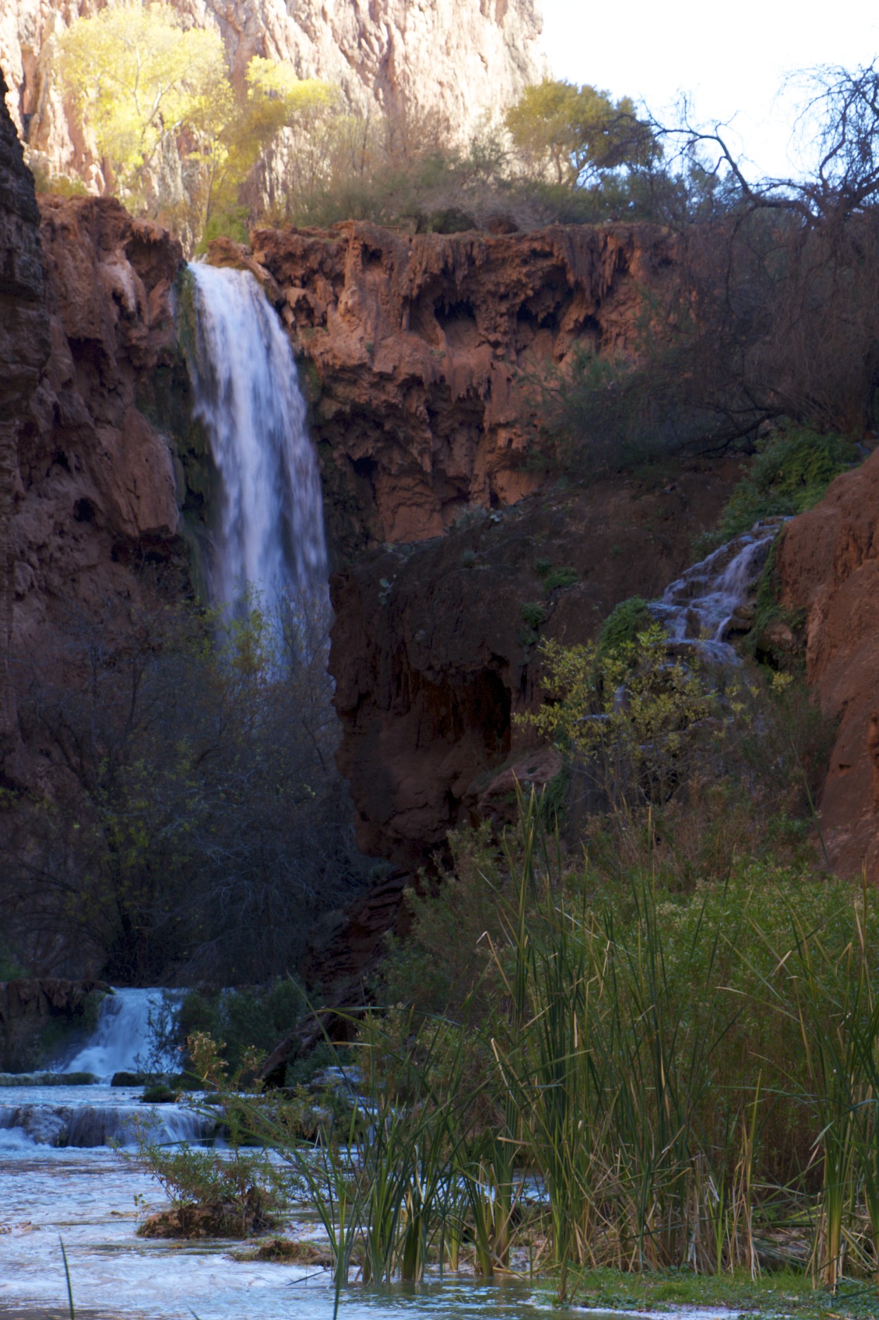
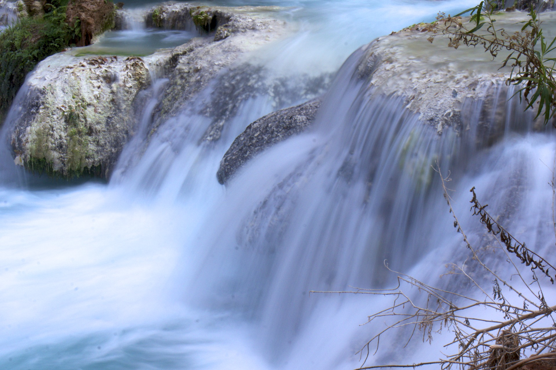
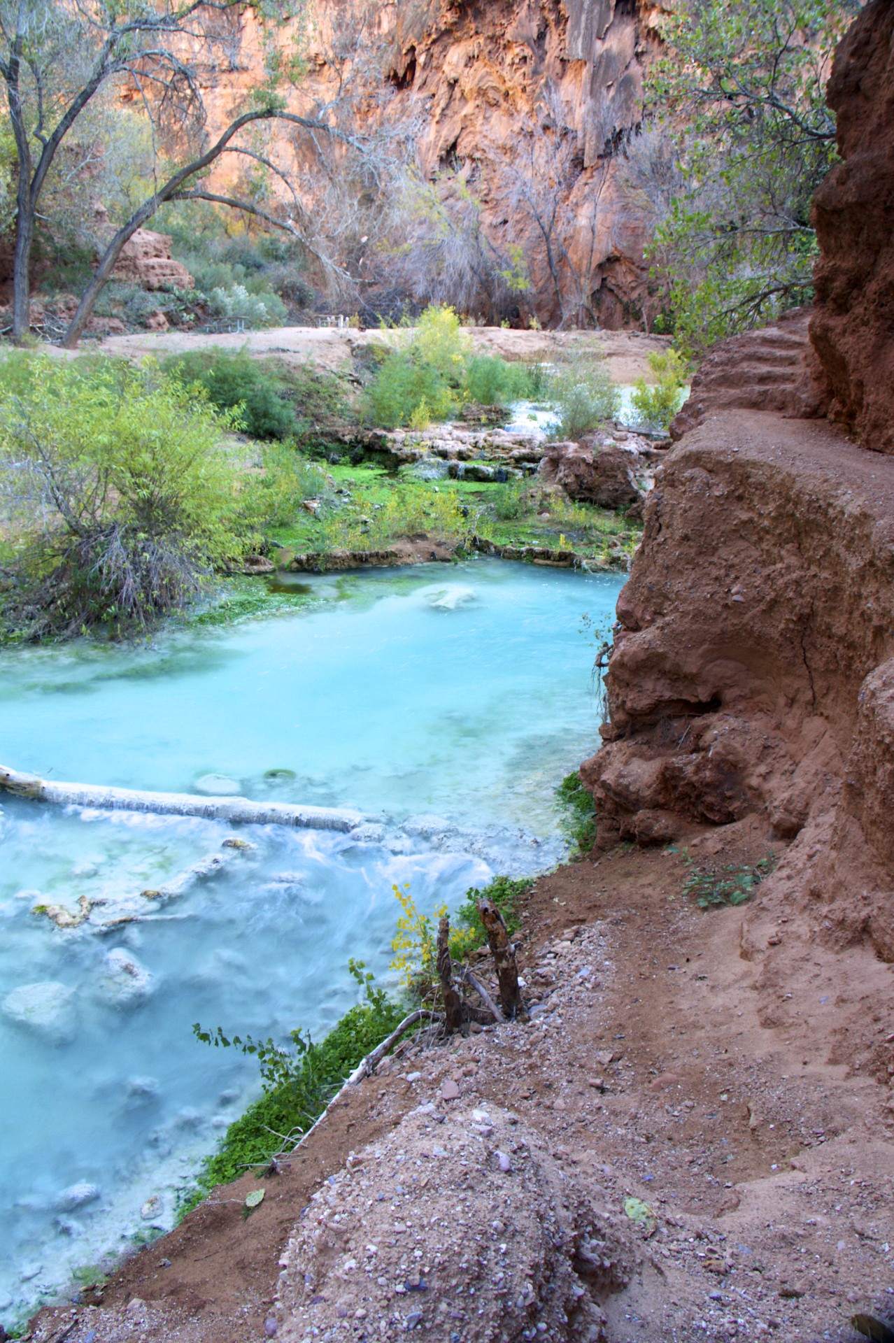
The water flowing down Havasu Creek contains large amounts of dissolved lime that it has leached out of the rocks upstream. This lends the water a distinct blue color, accentuated by the green plants that grow in it. The lime coats the creek bed and any objects in its path, quickly covering them with a hard white limestone shell. The pure white creek bed further increases the effect of the blue water which starts off as a clear deeper green up near the village and turns into a progressively milkier light blue as it progresses downstream, eventually achieving the color of a concrete swimming pool. As the water cascades off one of the numerous cliffs in its path the hot sun (in the summer at least) causes a significant portion of the water to evaporate, leaving its former cargo of dissolved limestone behind in aerosol form to attach to the first surface it touches, usually the cliff face, rapidly forming huge stalactites and giving the appearance of the cliff melting. Close examination of the cliffs reveals intricate networks of caves formed behind the stalactites, some large enough to crawl into although most are blocked by a tight mesh of limestone formations.
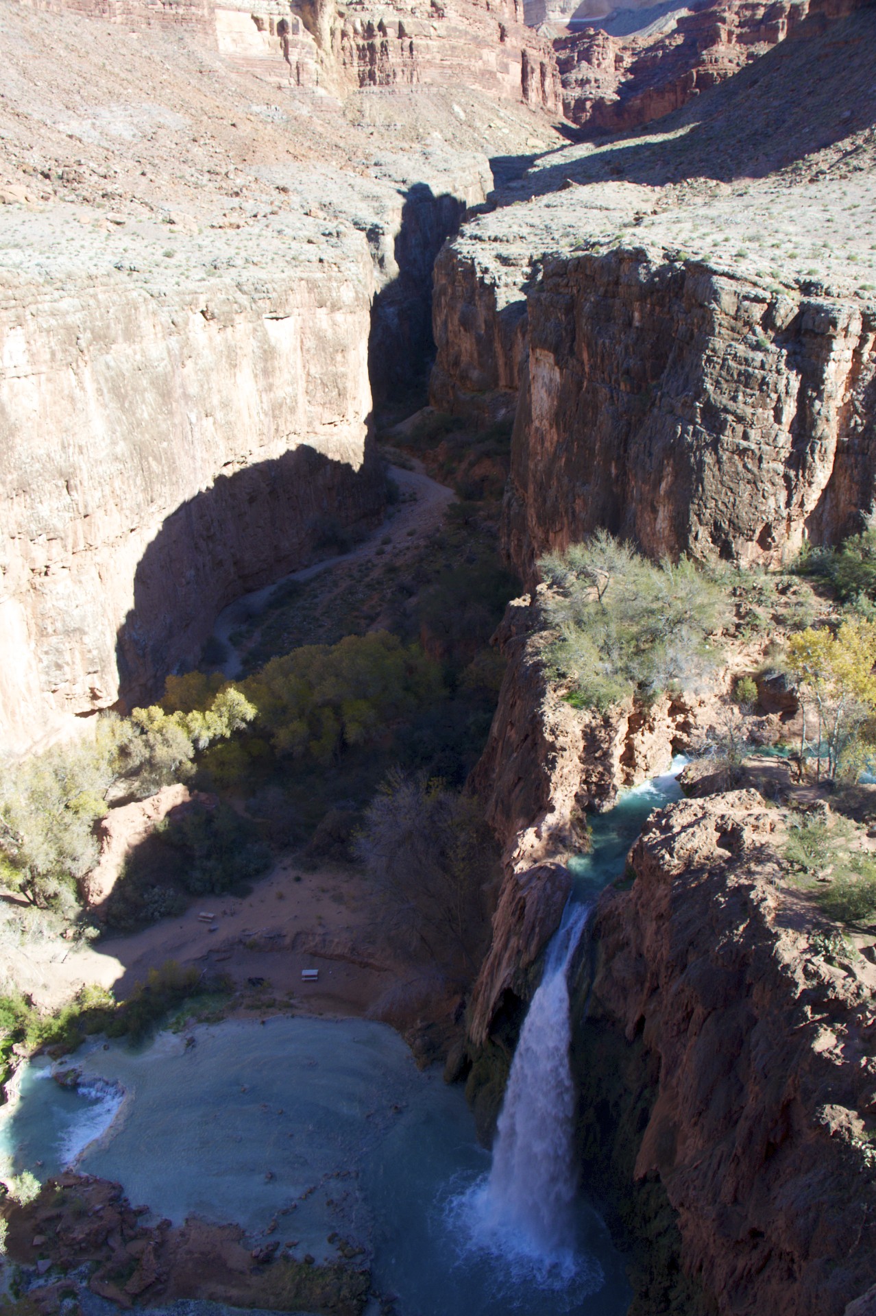
Further downstream the trail passes alongside Havasu Falls and a large pond at its base, perfect for swimming in as long as one doesn’t get too close to the waterfall itself. I had already decided that this was not the time of year for swimming but a group of Japanese tourists had a different idea and jumped into the cold water. Below Havasu Falls is the campground which still appears to be a work in progress with tools, picnic tables, and equine poop scattered about at random. A number of the old drift mines are in the campground area and I scrambled up to and went a little ways inside one of them but only having one headlamp, no rope, and having read that some of these go on for hundreds of feet I decided this exploration was best delayed until I had backup.
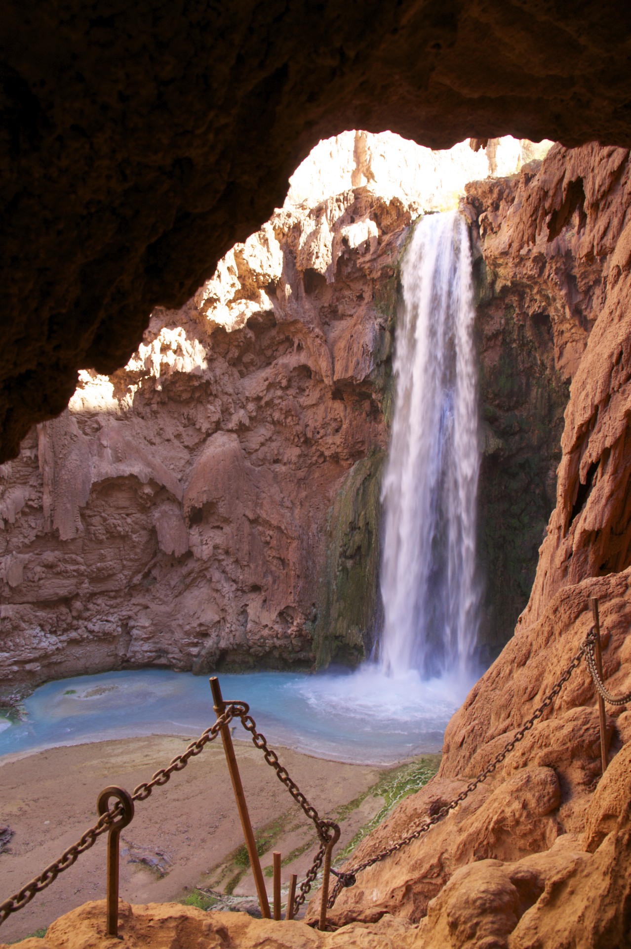
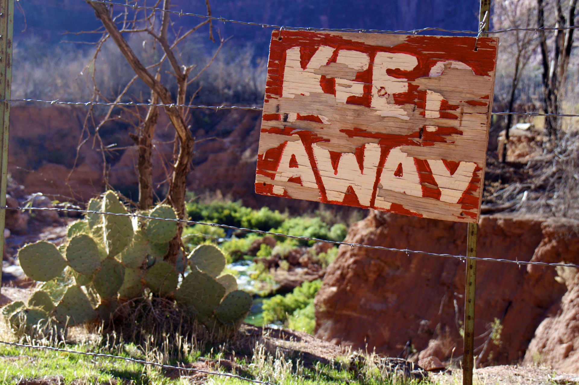
Beyond the campground the trail comes to the top of Mooney Falls and works its way out on a ledge past but still above the falls. Various rough hand painted signs in the usual Havasupai style exclaim “Descend at own risk!” as the trail starts to descend. This section of cliff contains a large number of the aforementioned limestone “pockets” that form miniature caves and while looking for a good vantage point to take a picture of the falls I found a particularly large one descending into the rock with what appeared to be stair steps carved into the bottom. Thinking I had found an interesting hideout I climbed in to find that the tunnel curved at the bottom and opened onto a balcony in the middle of the cliff face: a perfect spot for a photo. On the other side of the balcony was another hole in the rock, descending even further. Coming out the other side of this tunnel I found the top of a set of chains bolted into the rock descending a very steep limestone cliff face. It was about this time that it dawned on me that this was the way down, the tunnel that had been blasted through the rock to get to the bottom of the otherwise impassable falls. I don’t know what it is about this trip and sketchy climbs but this one certainly fell into that category as the chains and climbing route were both meandering wildly across the rock, often in opposite directions, and the closer the route got to the falls the wetter it got. The final decent to the bottom was on a steel ladder that had been chained to the rock, normally a safer bet for a descent than climbing on wet rock, but in this case after getting down far enough to actually see what I was climbing on it was pretty apparent that the latter was fairly well corroded, one rung already having given way and been replaced with an sawed off shovel handle. That’s the trouble with down climbing: you don’t get to see what you’re stepping on until you’re already past it. A few hundred yards downstream from Mooney Falls the creek changes from one side of the canyon to the other necessitating a crossing but there are no more bridges. Further downstream travel requires wading through the water which the temperature wasn’t conducive to so I turned back, exploring one of the narrow side canyons below Mooney Falls on the return trip. Fortunately climbing up is always easier than down so I made quick work of the ladders, chains, and tunnels to get back to the top of Mooney and into camp for the night.
The next day brought a completely different type of hike: along one of the benches above the canyon. The Grand Canyon isn’t s simple straight-sided ditch, the various layers of rock have all eroded at different rates to form stair-stepped sides leading down into the canyon with sharp vertical cliffs interrupted by flat or gently sloping benches. The plateau above the village reaches up to 6,000 feet above sea level, Hualapai Hilltop where the supply depot is located at 5,200 feet is on a narrow ledge halfway down between the plateau and the canyon floor at 4,200 feet. The wash below Hualapai Hilltop carves its way down through this valley floor until it opens into a wide valley at 3,200 feet where Supai is located, leaving the town surrounded by an intermediate bench at around 4,000 feet. The creek below what was Navajo Falls and is now the combination of New Navajo Falls and Rock Falls cuts deeper into this valley floor, reaching down to 2,600 feet at Mooney Falls and leaving behind yet another intermediate bench at around 3,000 feet. The most direct route (as the crow flies) back to the top of the plateau from Mooney Falls would require climbing 3 separate sets of cliffs and hiking across the level benches in between them. Interestingly easy access to the intermediate benches can be gained by heading upriver until sufficient elevation is gained, and then walking along the broad bench avoiding the river canyon below. Side canyons can frustrate this effort, requiring lengthy detours to avoid climbing, but there are no significant side canyons on the west side of Havasu Creek below Navajo Falls for a number of miles so that’s exactly what I did. A quick hike back to the village in the morning afforded access to a small bridge crossing to the west side of the creek above Navajo Falls and from that point it is as simple as walking back along the creek to the falls where the creek drops and turns what was formerly the valley floor in the vicinity of the village into the 3,000 foot bench, affording views of the remaining falls from hundreds of feet above.
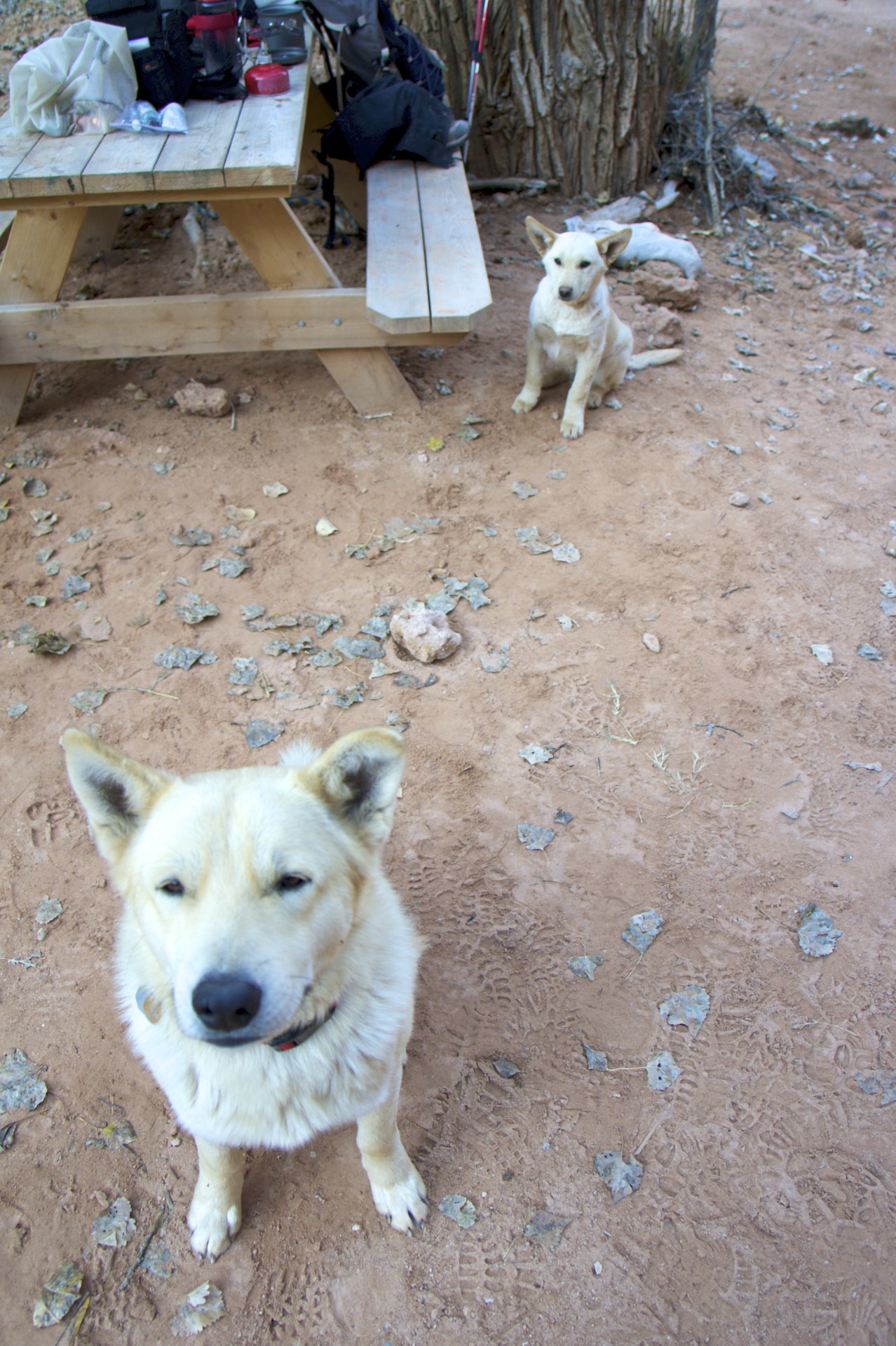
Back in camp that evening I was joined by a (presumably local) dog and his miniature clone who curled up for the night next to the tree in my camp. A “good cop/bad cop” routine followed the next morning as I was cooking breakfast: the elder dog would sit politely waiting for a handout while his junior was crawling and scrambling over everything. Neither tactic worked so they moved on to the Japanese camp next to mine. I’m sure this is a regular gig for these two in the busy summer season. A quick hike back to town just as the first helicopter of the day arrived and I was quickly back to Hualapai Hilltop and the rest of the world 8 miles away.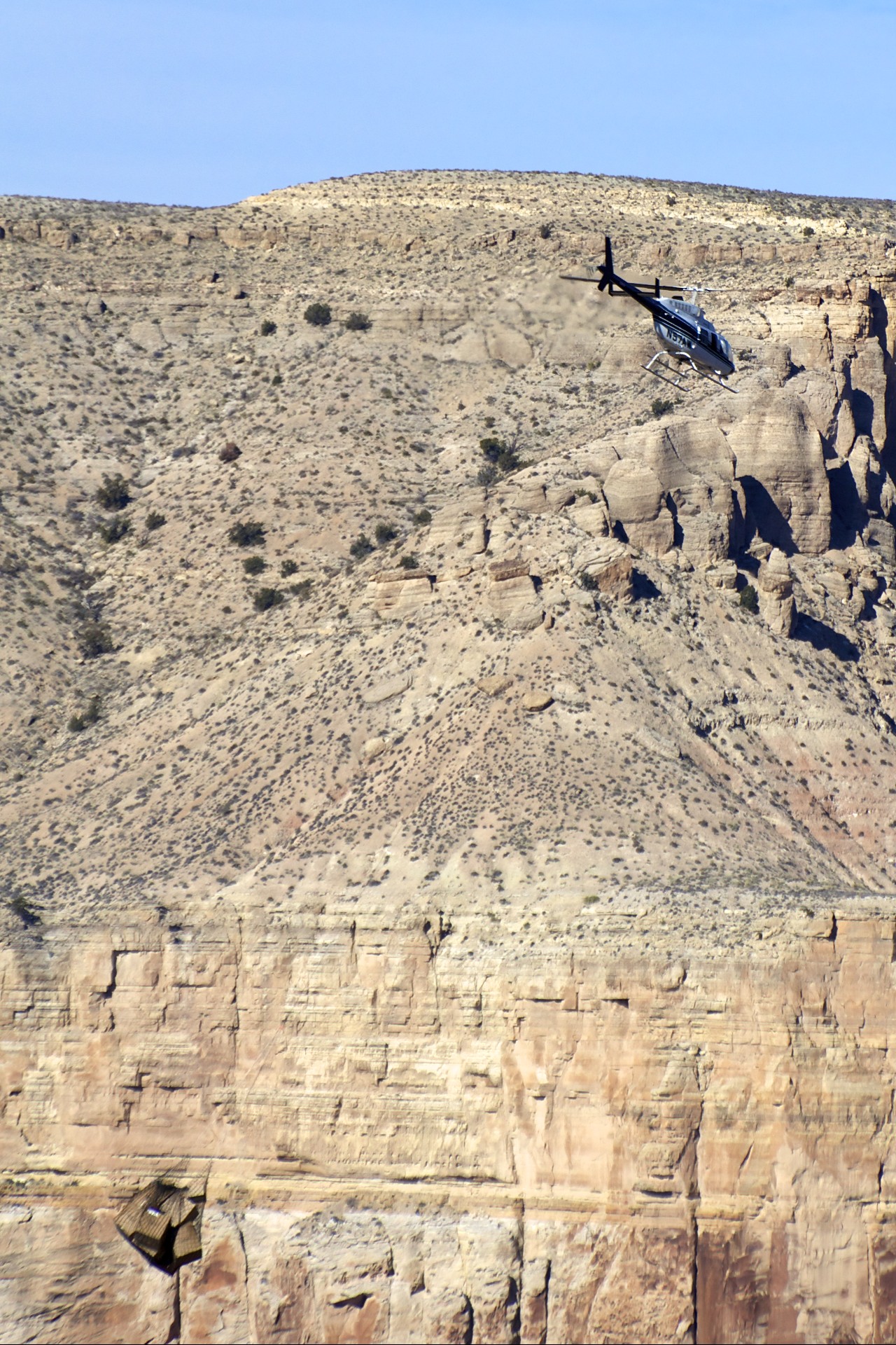


- Acadia National Park
- Adirondacks
- Aerial
- Airstream
- Ancient Bristlecone Pines
- Anza-Borrego
- Appalachian Trail
- Arches National Park
- Backpacking
- Bad Larry
- Bears Ears National Monument
- Boatpacking
- Boston
- Bryce Canyon National Park
- Canoeing
- Canyon de Chelly National Park
- Canyoneering
- Canyonlands National Park
- Capitol Reef National Park
- Caribbean
- Catskills
- Cities
- Climbing
- Colorado National Monument
- Colorado Plateau
- Death Valley National Park
- Europe
- Fisher Towers
- Grand Canyon National Park
- Grand Staircase-Escalante National Monument
- Grand Teton National Park
- Gunks
- Hiking
- Iceland
- Joshua Tree National Park
- Lassen Volcanic National Park
- Manzanar National Historic Site
- Mojave Desert
- Mojave National Preserve
- Mountaineering
- Mt Washington
- Mt Whitney
- Natural Bridges National Monument
- New York CIty
- Pacific Northwest
- Petrified Forest National Park
- Pinnacles National Monument
- Red Roamer
- Road Trips
- Rocky Mountains
- Ruins
- Sailing
- San Diego
- San Francisco
- Sequoia National Park
- Sierra Nevada
- Skiing
- Sonora Desert
- Spelunking
- Superbloom
- Superstition Mountains
- White Mountains
- Yellowstone National Park
- Yosemite National Park
- Zion National Park