Chris Roams
Travel, Adventures, and Photography
Back in the Sand
January 07, 2012
After crossing the Sierras I came down with a bit of a cold and took a few days “off” in a hotel to both recuperate and get some work done. I ended up in the first little foothill town with a reasonable motel and don’t have much to say about it. The western foothills of the Sierra was the epicenter of the California Gold Rush and today relies mostly on tourism and I expected to have time to sightsee after the inevitable snowstorm came and blocked the path back across the Sierras. After 4 days the snowstorm never came so I suited back up and crossed the Sierra Nevada again, at night this time, back into the desert. The Mother Lode will have to wait for another day.
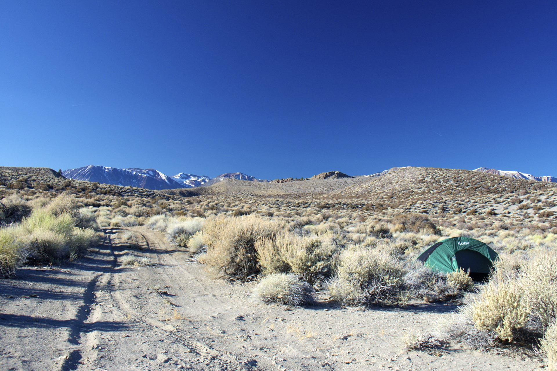
The western United States is an enormous area and, in a concept that is entirely foreign to anyone from the megalopolis along the eastern seaboard where leaving one town means entering another, much of the land is publicly owned. What this means in practical terms is that outside the towns (which are few and far between) and with the exclusion of certain areas including national parks, designated wilderness areas, air force bombing ranges, nuclear weapon test sites, and secret alien technology research hangars you can pretty much go anywhere and do anything you want. The Bureau of Land Management and the National Forest Service are the caretakers of this land which encompasses over 75% of the state of Nevada, 70% of Utah, and a bit over 30% of both California and Arizona where I’ve been traveling these past months. This is the “open range” of the cowboys where cattle roam free and the weary traveller is free to set up camp wherever he may be when the sun sets (“dispersed camping” in the parlance of the BLM and NFS, “boondocking” in the parlance of the people who actually practice it). This is the ultimate freedom, unlike in the national parks there are no permits, no fees, and usually no bathrooms, just pick a spot and set up camp. If you’re lucky you can find where someone has been before and will have a fire ring ready-made. I spent my night boondocked near the southern shore of Mono Lake.
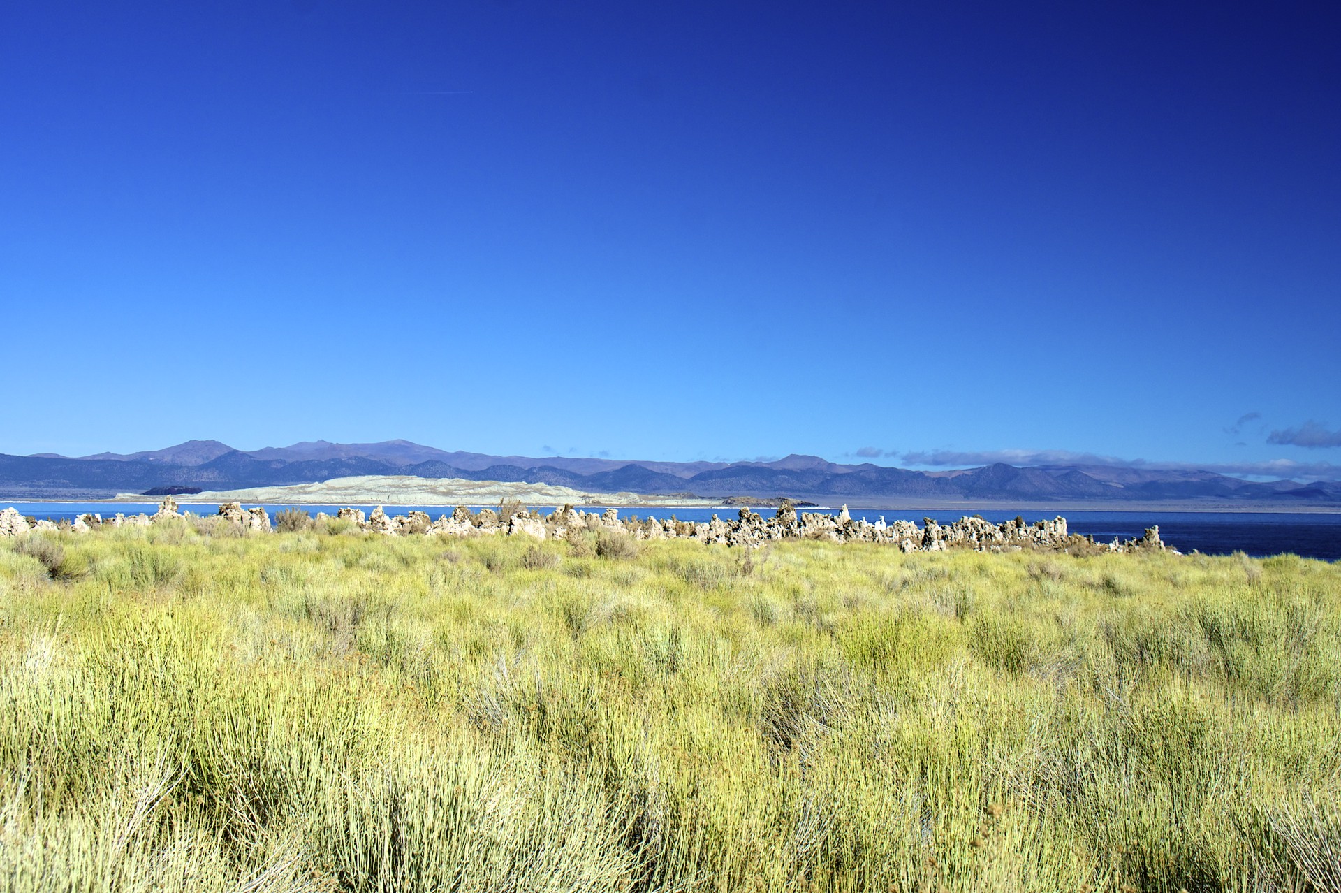
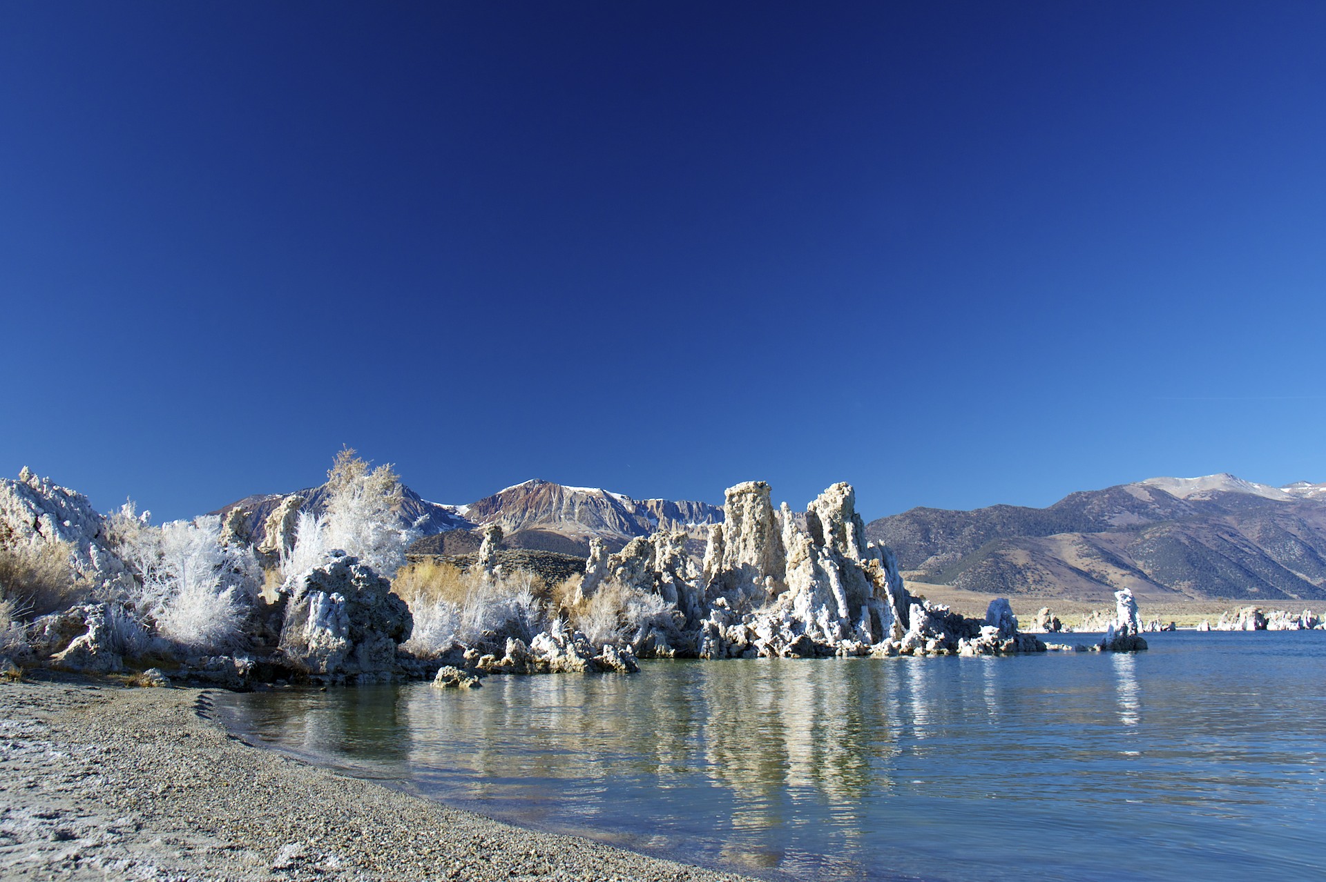
Mono Lake lies at the eastern end of the road down from Tioga Pass, wedged between the Sierras and the Great Basin Desert, just north of the Owens Valley. 13 miles long and 9 miles wide Mono Lake is a near twin to what once was Owens Lake 100 miles to the south, with no outlets the salts and minerals washed out of the mountains by its tributaries are stuck in the lake after the water evaporates in the desert sun resulting in alkaline water with twice as much salt as the ocean. Fresh water bubbles up from seeps in the floor of the lake, where it forces dissolved minerals out of solution which then collect in enormous limestone columns over the springs called tufa. The salty water is home to an enormous number of brine shrimp, and 2 islands in the lake host millions of birds who stop during their migrations to take advantage of this food resource.
Also like Owens Lake to the south, Mono Lake was another battleground in the California Water Wars. Only a decade after sucking Owens Valley dry Los Angeles was thirsty for more water and turned here, to the next basin to the north. In 1941 an extension on the Los Angeles aqueduct was completed and Mono Lake’s freshwater tributaries were diverted into the tunnels. Just as at Owens Lake with the water supply cut off the lake began to shrink, becoming more saline and alkaline as it went. a doubling of the salinity and a halt in the natural oxygen mixing processes as the lake dropped threatened the loss of the birds’ food supply, but the drop also presented a direct threat in the form of a land bridge created by the receding water exposing the birds’ nesting sites on the islands to predators for the first time. Today the exposed tufa columns show just how far the lake’s level has fallen (the tufa columns only form under water).
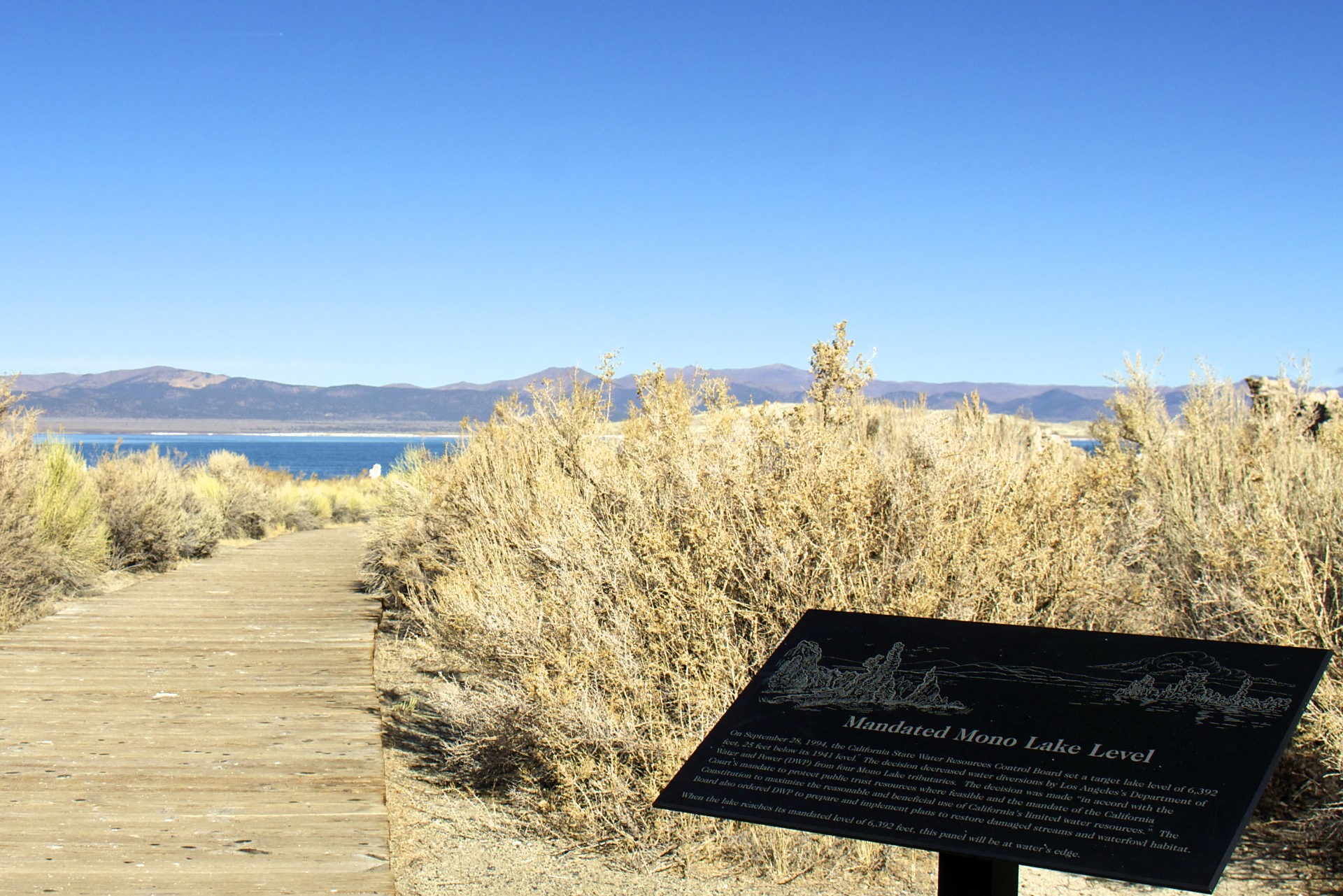
Court battles were started in the 1980s by the National Audubon Society that resulted in a 1994 protection order for the lake requiring Los Angeles to raise the lake to it’s 1960 level, 20 feet higher than it stood in the 1980′s but still 25 feet short of its natural 1941 level. Now, 18 year after the court ruling, the lake is still 8 feet short of the target. This may not seem like a large number but 8 feet over the lakes 100 square miles in an enormous amount. Looking out at the shoreline some 100 yards distant from a sign placed at the target elevation shows just how much 8 feet really is, looking up at the columns of tufa towering over land condemned by the court to remain dry shows how little 8 feet really is.
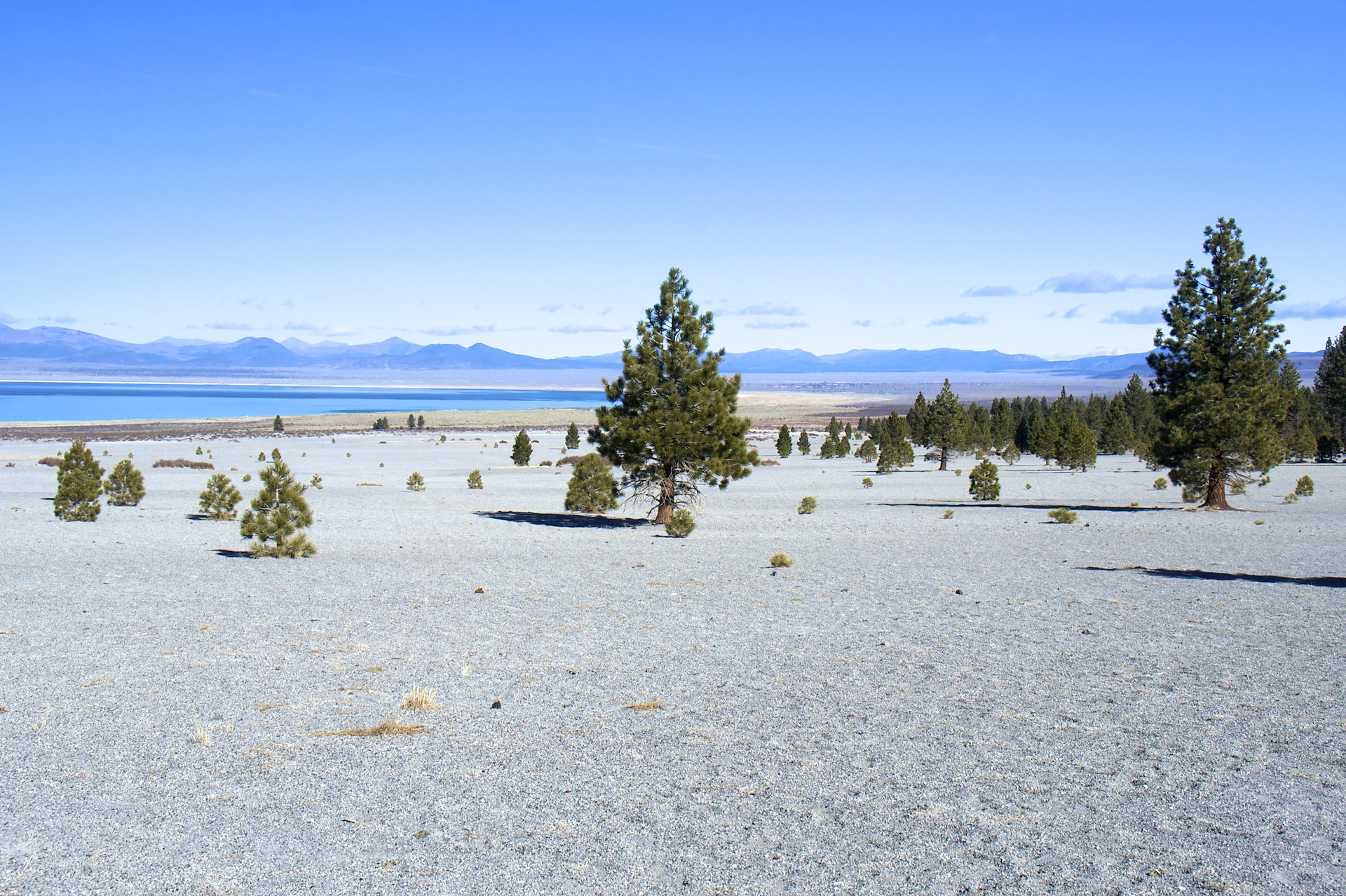
The area around Mono Lake is a hotbed of volcanic activity (excuse the pun). A chain of extinct volcanos marches off to the south, their cinder cones blocked off with obsidian plugs. Open scree slopes, barren except for a few scattered trees, extend almost down to the lake itself. In fact the 2 islands in Mono Lake are the most recent in this chain of volcanoes, the larger of the islands being only about 350 years old. Hot springs off to the southwest are indicators that the forces that formed this area aren’t quite done yet.


- Acadia National Park
- Adirondacks
- Aerial
- Airstream
- Ancient Bristlecone Pines
- Anza-Borrego
- Appalachian Trail
- Arches National Park
- Backpacking
- Bad Larry
- Bears Ears National Monument
- Boatpacking
- Boston
- Bryce Canyon National Park
- Canoeing
- Canyon de Chelly National Park
- Canyoneering
- Canyonlands National Park
- Capitol Reef National Park
- Caribbean
- Catskills
- Cities
- Climbing
- Colorado National Monument
- Colorado Plateau
- Death Valley National Park
- Europe
- Fisher Towers
- Grand Canyon National Park
- Grand Staircase-Escalante National Monument
- Grand Teton National Park
- Gunks
- Hiking
- Iceland
- Joshua Tree National Park
- Lassen Volcanic National Park
- Manzanar National Historic Site
- Mojave Desert
- Mojave National Preserve
- Mountaineering
- Mt Washington
- Mt Whitney
- Natural Bridges National Monument
- New York CIty
- Pacific Northwest
- Petrified Forest National Park
- Pinnacles National Monument
- Red Roamer
- Road Trips
- Rocky Mountains
- Ruins
- Sailing
- San Diego
- San Francisco
- Sequoia National Park
- Sierra Nevada
- Skiing
- Sonora Desert
- Spelunking
- Superbloom
- Superstition Mountains
- White Mountains
- Yellowstone National Park
- Yosemite National Park
- Zion National Park