Chris Roams
Travel, Adventures, and Photography
Half Dome
September 18, 2011
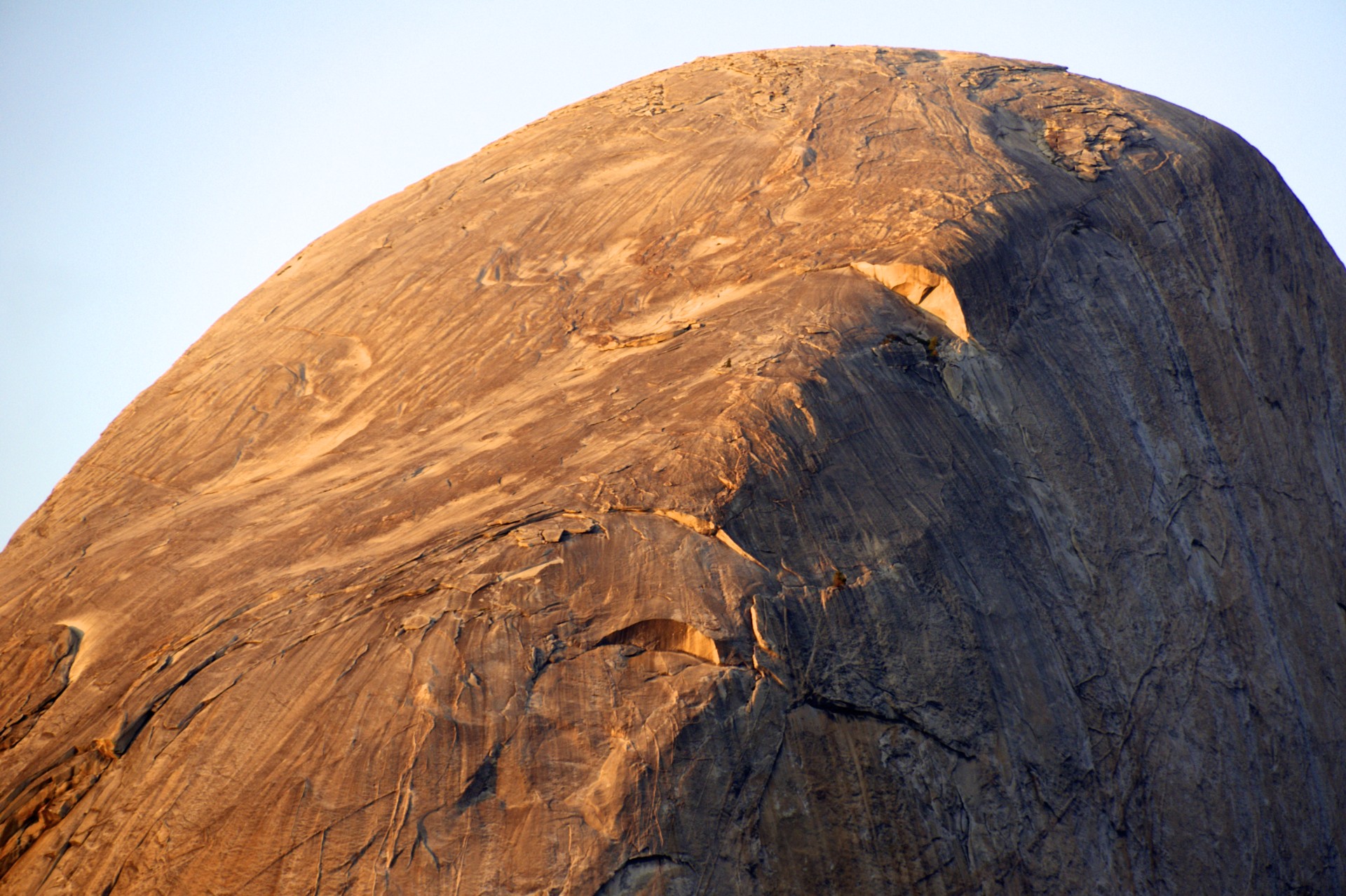
Half Dome is one of the most iconic landmarks in the United States, the centerpiece of Yosemite National Park. From Ansel Adams prints down to the logo of The North Face (a reference to the north face of Half Dome as represented in their logo) nearly everyone has been exposed to it even if they don’t know it by name. Yosemite’s big-wall granite is a mecca for rock climbers and although half dome was once throughout to be unclimbable today it is no exception. Numerous routes work their way up the granite monolith to the peak over 4,700 feet above the valley floor. Some follow the smooth curves on the east and west flanks of the mountain while others go straight up the sheer vertical north face.
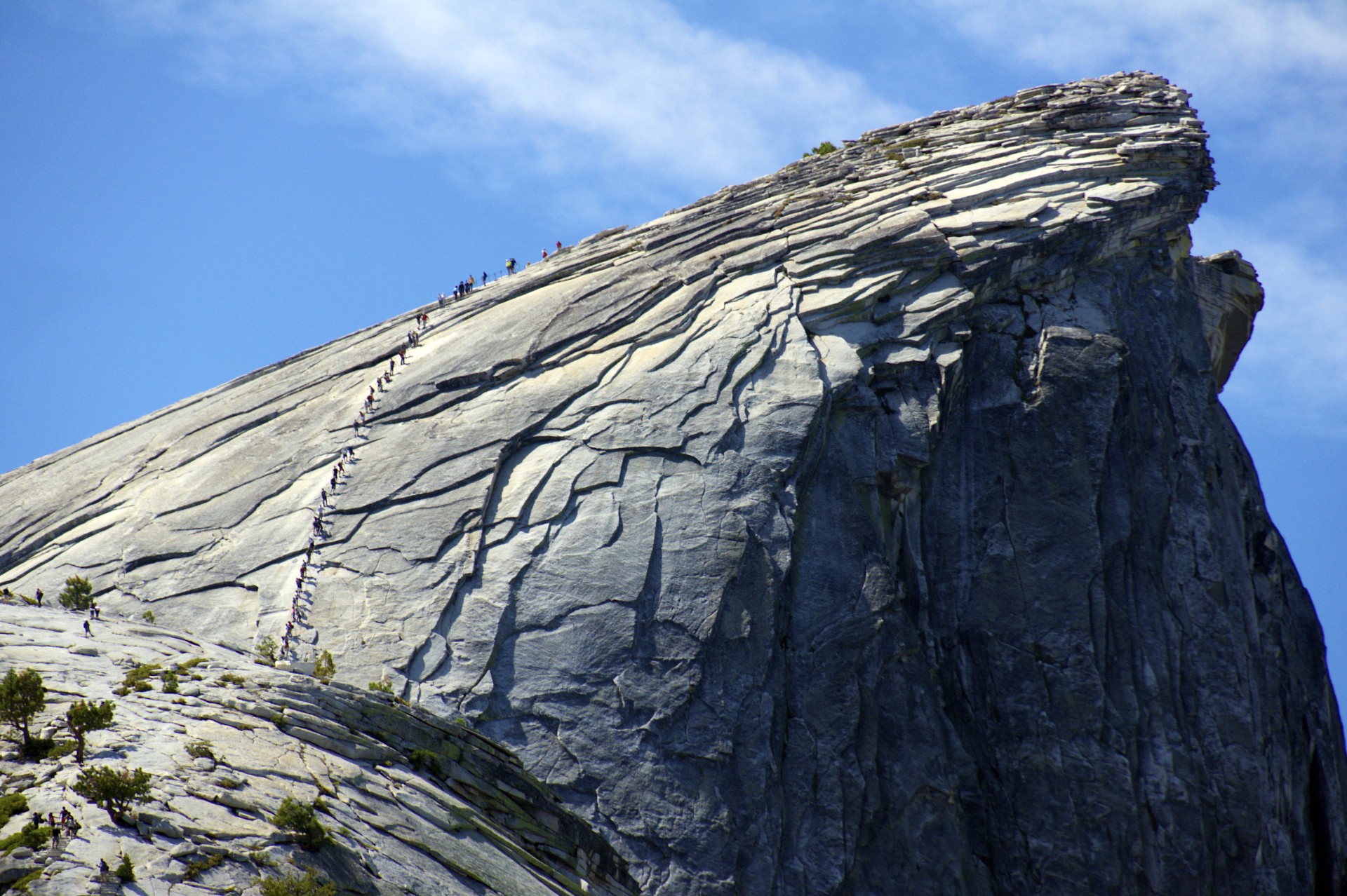
The most popular route up Half Dome, and the only one that doesn’t require bringing your own rope, is the cables route on the eastern edge. A series of steel cables have been bolted into the rock and during the summer are held up on poles like a pair of handrails. This route has become so popular that the National Park Service issues a limited number of permits to prevent overcrowding (normally only overnight trips in Yosemite require permits). While I didn’t have any hope of getting a day-hike permit there is another way, certain overnight permits also allow access to the Half Dome cables and the park service reserves a number of these permits for walk-ins the day before their trip. I was lucky enough to walk in looking for a next-day permit only to find out that there was a leftover from the day before, I was on my way.
Even getting to the cables is a difficult proposition requiring 7 miles of hiking and 4,500 feet of elevation gain from the valley floor, but there is an easier way: Glacier Point is just west of Half Dome and is itself 3,250 feet above the valley floor, and it’s reachable by car. Rather than a grueling hike up from the valley floor it’s an easy stroll downhill from Glacier Point, across the top of Nevada Falls, and into the campsite at Little Yosemite Valley just behind Half Dome “only” 3.5 miles and 2,700 feet from the top, this is as easy as it gets without a helicopter. This was also fortunate as my same-day permit resulted in an evening start by the time I finished getting supplies in the valley and driving to Glacier Point.
The cables themselves are a showcase for the various methods that people use to deal with stress. It was obvious that most of the hikers were not rock climbers and that these cables were the most “extreme” thing they had ever done. Some people scream and yell, some just lay down on the rock and refuse to move, and others go on the outside of the cables and sprint past the line to get to the top as quickly as possible. What shocked me the most is how few people were wearing harnesses, every year or two someone dies after falling off the cables and given the crowds it would be very easy for one person to slip and knock others down. Via Ferrata kits as used in the alps are perfect for clipping into the cables and I certainly used one me for piece of mind even though I probably have more rock climbing experience than most of the hikers on the cables. At the end of the day this hike is supposed to be fun and if clipping in so that a simple slip-and-fall won’t be fatal takes it from terrifying to enjoyable it’s certainly worth doing.
It never ceases to amaze me how un-prepared some people are when they head into the backcountry. Despite the high-flying acrobatics of Yosemite’s rock climbers the vast majority of rescues are called out for underprepared hikers. When I was just about to leave camp in the morning to head up Half Dome a woman in running attire with an empty water bottle and no backpack jogged into camp and asked where the tap was, as in water tap, 4 miles from the nearest road. I informed her there was no tap and that that up here in the backcountry we pulled our water out of the river and treated it ourselves. Apparently she was meeting someone who was coming in from Tenaya Lake (11 miles away, uphill the whole way). I had just filtered a few liters of water so I filled her little bottle up but I can’t imagine it got her very far. Hopefully she ran into some more kind backpackers along the way.
The trip up Half Dome was fairly uneventful, I hung around until I was the second to last person to leave the top and then went back down to my campsite at Little Yosemite Valley. On any given day in-season a few dozen campers can be found at this campground, usually either spending the night on their way to Half Dome as I had the night before or spending the night after summiting as I was doing this night, and the communal campfire is a forum for the hikers who have just finished the hike to transfer the little bits of knowledge and insight to the hikers who were going to make the attempt the next day (the sub-dome is more tiring than the cables, get a pair of gloves from the pile at the bottom of the cables if you didn’t bring any, don’t put your pack down or the chipmunks, squirrels, and marmots will eat your food, etc.).
The next morning one of the other hikers from the previous night’s fire was heading down to the Valley via the Muir Trail and offered to give me a ride back up to my rental car parked at Glacier Point. This was the best possible scenario, rather than hiking all the way back up to Glacier Point I could head downhill to the valley. I got to play tour guide as my companion had come up via the Mist Trail and I had hiked up the Muir Trail a few years previously and knew my way around the confusing intersections. After a few more uneventful hours we emerged back into the tourist crowds of Yosemite Valley.
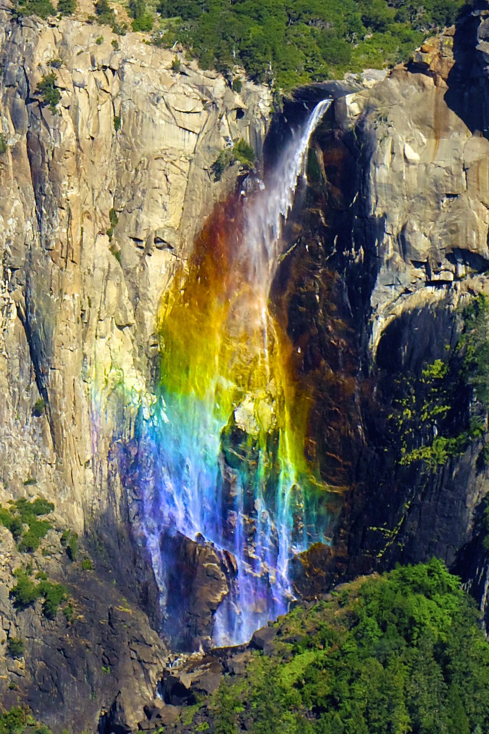
On my drive back down from Glacier Point I happened to stop at Tunnel View at just the right moment for the sun to form a rainbow in Bridal Veil Falls and for the wind to blow the normally thin cascade into a broad sheet of mist. A great end to a great hike.


- Acadia National Park
- Adirondacks
- Aerial
- Airstream
- Ancient Bristlecone Pines
- Anza-Borrego
- Appalachian Trail
- Arches National Park
- Backpacking
- Bad Larry
- Bears Ears National Monument
- Boatpacking
- Boston
- Bryce Canyon National Park
- Canoeing
- Canyon de Chelly National Park
- Canyoneering
- Canyonlands National Park
- Capitol Reef National Park
- Caribbean
- Catskills
- Cities
- Climbing
- Colorado National Monument
- Colorado Plateau
- Death Valley National Park
- Europe
- Fisher Towers
- Grand Canyon National Park
- Grand Staircase-Escalante National Monument
- Grand Teton National Park
- Gunks
- Hiking
- Iceland
- Joshua Tree National Park
- Lassen Volcanic National Park
- Manzanar National Historic Site
- Mojave Desert
- Mojave National Preserve
- Mountaineering
- Mt Washington
- Mt Whitney
- Natural Bridges National Monument
- New York CIty
- Pacific Northwest
- Petrified Forest National Park
- Pinnacles National Monument
- Red Roamer
- Road Trips
- Rocky Mountains
- Ruins
- Sailing
- San Diego
- San Francisco
- Sequoia National Park
- Sierra Nevada
- Skiing
- Sonora Desert
- Spelunking
- Superbloom
- Superstition Mountains
- White Mountains
- Yellowstone National Park
- Yosemite National Park
- Zion National Park